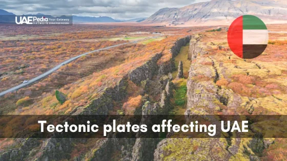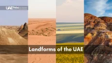
Did you know the UAE’s rugged mountain ranges weren’t always part of the scenery? Beneath the desert’s golden sands and Abu Dhabi’s sleek skyline lies a geological story written over millions of years—a tale of colliding giants and slow-motion transformations.
Imagine standing in the Hajar Mountains, tracing your fingers across ancient rock layers that ripple like frozen waves. These peaks didn’t emerge overnight. They’re the result of continental collisions that still shape the United Arab Emirates today. The region sits where the Arabian Plate meets its neighbors, creating a geological frontier that molds everything from coastal plains to limestone ridges.
This constant push-and-pull explains why you’ll find ocean fossils in desert rocks or why certain tectonic forces continue to subtly reshape the land. The process works like nature’s 3D printer—layer upon layer of sediment compressed into striking formations, then weathered into the Instagram-worthy cliffs and wadis we explore now.
- Nature’s slow dance: Continental shifts created the Emirates’ signature peaks and valleys
- Desert time capsule: Rock formations reveal clues about the region’s aquatic past
- Living landscape: Geological activity still influences modern terrain and ecosystems
Understanding Tectonic Plates and Geological Fundamentals
Picture Earth’s surface as a giant jigsaw puzzle—except the pieces move slower than traffic on Sheikh Zayed Road. These puzzle pieces, called tectonic plates, glide across molten rock below, reshaping continents over millions of years. Some crash like bumper cars, others drift apart like shy acquaintances. That’s how mountains rise, oceans widen, and valleys form.
Fundamental Principles of Plate Tectonics
Think of the planet’s crust as a cracked eggshell. The cracks divide it into seven major plates and dozens of smaller ones. Heat from Earth’s core keeps these slabs in motion—about as fast as your fingernails grow. When they collide, one might dive beneath another (subduction) or crumple upward (uplift). “It’s nature’s slow-motion ballet,” says geologist Dr. Layla Al-Mansoori. “Every earthquake? Just a misstep in the dance.”
How Plate Movements Shape Global Landscapes
Where plates meet, drama unfolds. Pull-apart zones create rift valleys like East Africa’s. Collisions birth skyscraping peaks like the Himalayas. The Arabian Plate—home to the United Arab Emirates—is sliding northward, nudging against Eurasia. This gentle push explains why limestone layers here resemble a geological layer cake. Even today, this interaction subtly tilts coastlines and lifts ancient seabeds into desert ridges.
Want proof? Check rocks near Jebel Hafeet. You’ll find marine fossils trapped in stone—reminders that today’s dunes were once ocean floors. It’s like Earth’s own Instagram story, showing behind-the-scenes clips of its makeover journey.
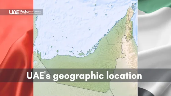
The Arabian Plate: Its Role in the UAE Landscape
Imagine unfolding a map of the Middle East and pressing your finger where desert sands meet jagged peaks—that’s where the Emirates’ geological magic happens. The country perches on the northeastern edge of the Arabian Peninsula’s massive plate, like a passenger riding Earth’s slowest-moving train.
Positioning of the Emirates on the Arabian Plate
Let’s zoom in: the entire Arab Emirates sits where the Arabian Plate’s leading edge nudges against Eurasia. Picture this as a geological handshake that started 40 million years ago—and never stopped. Over millennia, this persistent push sculpted limestone layers into the region’s signature ridges and wadis. Coastal areas near Abu Dhabi? Those sandy stretches owe their flatness to being farther from the plate’s active margin.
Interactions With the Eurasian Plate
When these two colossal plates meet, it’s less like a car crash and more like a slow-motion tango. The Arabian Plate dips slightly beneath its Eurasian partner, creating uplift forces that built the region’s mountain backbone. “It’s a dance of pressure and resistance,” explains geologist Dr. Amal Khalid. “Every millimeter of movement leaves its mark.”
Today, this convergence still whispers through the land. Gentle tremors occasionally ripple across the Hajar range, while erosion carves new patterns into ancient rock. Next time you hike a desert trail, look for tilted sedimentary layers—they’re nature’s history book, pages warped by endless continental persuasion.
Exploring UAE Tectonic Plates in Detail
What if the ground beneath your feet was a slow-motion artist? That’s essentially what’s happening across this desert nation—crustal movements so gradual they’d make hourglasses yawn, yet powerful enough to sculpt entire skylines. Let’s unpack the forces carving tomorrow’s postcard views today.
Defining Crustal Movements and Their Dance
Here’s the backstage secret: the region’s crust behaves like a geological multitasker. While Abu Dhabi’s coastal plains stay relatively calm, the northern Emirates experience crustal compression strong enough to fold limestone like origami. Think of it as Earth’s version of a slow-motion trampoline—some areas dip while others spring upward over millennia.
Impact on Regional Mountain Building
Pressure from plate interactions acts like invisible hands kneading dough. As crustal layers crumple, they push upward to form jagged peaks. Jebel Jais—the country’s highest point—owes its stature to this relentless uplift. “It’s like watching a rug bunch up when you push it across a floor,” explains geologist Dr. Omar Al-Hassan. “Except here, the floor is molten rock, and the rug is 10 million years old.”
This process explains why the Hajar range resembles a stone accordion. Each ridge and valley tells of ancient collisions that continue shaping hiking trails and wadis. Next time you spot tilted rock layers near Ras Al Khaimah, you’re literally seeing Earth’s crust caught mid-stretch—a snapshot of our planet’s endless makeover.
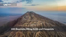
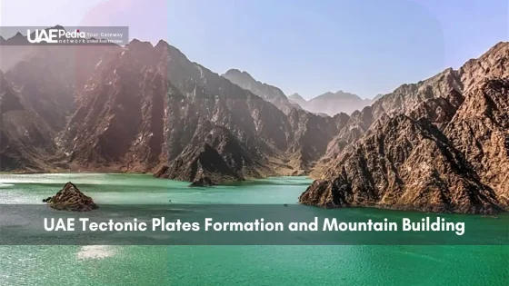
Formation and Significance of the Hajar Mountains
Have you ever touched a mountain that’s still growing? The Hajar range offers exactly that—a living laboratory where Earth’s crust folds, fractures, and rises in real time. This geological belt stretches like a stony backbone across the eastern Emirates, shaped by forces powerful enough to lift ancient seabeds into jagged peaks.
Tectonic Collision and Uplift Processes
Picture two continental giants slow-dancing over millions of years. As the Arabian landmass pressed northward, it crumpled rock layers into the Hajars’ dramatic folds. The process works like nature’s origami—sedimentary limestone bends and snaps under pressure, creating cliffs that tower over desert plains.
Today, this collision zone still breathes. Gentle uplifts nudge the range higher by millimeters yearly, while erosion carves wadis through softer rock. “It’s a tug-of-war between creation and destruction,” notes geologist Dr. Amina Al-Rashid. “Every landslide reveals new chapters in the mountains’ story.”
| Geological Feature | Formation Process | Modern Impact |
|---|---|---|
| Jebel Shams | Compressed limestone layers | Popular hiking destination |
| Wadi Bani Khalid | River erosion along fault lines | Oasis ecosystems |
| Fossil-rich strata | Ancient seabed uplift | Scientific research sites |
Geological Importance of the Hajar Range
Beyond their rugged beauty, these mountains serve as climate engineers. Their heights trap moisture from Arabian Sea winds, creating microclimates where rare plants thrive. Bedouin communities have long used the range’s seasonal streams and sheltered caves—proof that geology shapes culture as much as landscapes.
From Abu Dhabi’s skyscrapers, the Hajars seem distant. But their formation influences everything from groundwater reserves to desert biodiversity. Next time you spot their silhouette at sunset, remember: you’re witnessing Earth’s autobiography written in stone.
Plate Collision, Earthquakes, and Seismic Activity
Ever felt the ground whisper beneath your feet? That’s Earth’s way of reminding us it’s still at work. Where continental forces collide, they sculpt valleys and peaks while storing energy that occasionally shakes loose—a reminder that our landscapes remain works in progress.
How Collisions Create Topographical Diversity
When plates grind against each other, they act like nature’s sculpting tools. Compressional forces fold rock layers into ridges, while tension cracks create valleys. Near Jebel Hafeet, you’ll see tilted limestone cliffs—evidence of these slow-motion clashes. “Every earthquake releases pent-up energy that reshapes the land,” notes geologist Dr. Farah Al-Mehairi. “It’s Earth’s creative destruction.”
Seismic Patterns in the Region
Most tremors here register below magnitude 4—more wobble than danger. Northern areas near the Oman border experience more activity, while coastal zones like Abu Dhabi remain quieter. Modern networks of sensors now track these vibrations 24/7, feeding real-time data to urban planners. This tech helps engineers design quake-resistant infrastructure without sacrificing the skyline’s sleek curves.
| Area | Average Magnitude | Monitoring Stations |
|---|---|---|
| Northern Emirates | 3.2 | 18 |
| Abu Dhabi | 2.1 | 9 |
| Hajar Mountains | 3.8 | 12 |
These processes aren’t just geological footnotes—they’re active collaborators in shaping where we hike, build, and live. Next time your phone buzzes with an emergency alert, remember: it’s Earth’s way of keeping the conversation going.
Historical Evolution of the UAE’s Geological Landscape
What if you could flip through Earth’s scrapbook? The Emirates’ terrain reveals chapters written in stone—a 150-million-year saga of shifting crust and patient transformation. Let’s walk through time to understand how yesterday’s seabeds became today’s hiking trails.
Timeline of Major Events
Our journey begins underwater. Around 150 million years ago, this region lay beneath a shallow sea. Layers of sediments piled up like pages in a book—future limestone waiting for its moment. Fast-forward 100 million years: continental forces began folding these layers into early ridges.
| Time Period | Event | Modern Impact |
|---|---|---|
| 150 MYA | Marine sediment deposition | Limestone cliffs near Fujairah |
| 40 MYA | Collision processes begin | Hajar Mountain foundations |
| 20 MYA | Major uplift phase | Jebel Hafeet’s tilted strata |
| 5 MYA | Modern range formation | Wadi Bih hiking routes |
From Sediments to Mountain Ranges
Those ancient seabed layers didn’t just rise—they got a makeover. Compression squeezed sediments into durable rock, while erosion carved dramatic peaks. “It’s like baking a layer cake, then slicing it with nature’s knife,” says geologist Dr. Yasmin Al-Haddad.
In Abu Dhabi’s eastern regions, you’ll find fossilized coral reefs now towering 1,000 meters above sea level. These formations influence everything from groundwater flow to where developers plan new roads. Bedouin tribes once navigated by these stone landmarks—today’s hikers follow similar paths, tracing routes shaped by forces older than dinosaurs.
Next time you drive past Jebel Ali’s limestone outcrops, remember: you’re glimpsing pages from a planetary diary that’s still being written.
Coastal Dynamics: Subduction Zones and Their Influence
Ever wonder why some beaches vanish while new islands appear? Along the Gulf of Oman’s edge, Earth’s crust plays a slow-motion game of hide-and-seek. Here, the oceanic floor slides beneath continents—a process reshaping shorelines while you sip karak tea.
Insights into the Makran Subduction Zone
The Makran zone acts like nature’s conveyor belt. Over centuries, the oceanic crust here dives under Eurasia, dragging sediments deep underground. This creates underwater canyons and triggers subtle uplifts along the coast. “It’s a geological recycling program,” says marine geologist Dr. Nasser Al-Hammadi. “Old seafloor becomes tomorrow’s cliffs.”
Effects on Coastlines and Sediments
Abu Dhabi’s shores tell this story. Sands near Saadiyat Island shift as subduction tilts the seafloor. Further east, mangrove forests thrive where nutrient-rich sediments surface. These areas showcase how Earth’s hidden movements craft living landscapes.
| Coastal Feature | Subduction Impact | Observation |
|---|---|---|
| Musandam Peninsula | Uplifted limestone | Dramatic fjord-like cliffs |
| Al Dhafra Region | Sediment deposition | Expanding salt flats |
| Gulf of Oman Shelf | Tectonic tilting | Changing fishing grounds |
Modern sensors now track these shifts in real time. Data reveals how underwater landslides redistribute sands—crucial intel for protecting ports and coral reefs. Next time you stroll a Dubai beach, remember: every grain beneath your toes has a tectonic backstory.
Modern Tectonic Monitoring and Urban Safety Measures
What if skyscrapers could text you seismic updates? Cities across the region now use geeky guardian angels—networks of hyper-sensitive sensors that whisper tectonic secrets to urban planners. These systems blend centuries of geological wisdom with cutting-edge tech to keep growing metropolises safe.
Advances in Earthquake and Seismic Data Collection
Today’s monitoring tools resemble Earth’s nervous system. Fiber-optic cables detect crust movements finer than a human hair’s width. Satellite networks map millimeter-scale ground shifts monthly. “We’ve gone from guessing to granular,” says geologist Dr. Khalid Al-Farsi. “Our sensors now catch tremors weaker than a passing truck.”
Machine learning algorithms digest this data buffet 24/7. They spot patterns humans might miss—like subtle stress buildups near fault lines. This tech helped predict a 3.4-magnitude event near the Oman border last year, giving engineers 72 hours to check critical infrastructure.
Integrating Tectonic Data in Urban Planning
In coastal areas, zoning maps now include “seismic susceptibility” overlays. Architects use this intel to design foundations that flex like palm trees during quakes. Abu Dhabi’s Saadiyat Island cultural district stands on shock-absorbent materials tested against 200-year seismic models.
| Application | Technology Used | Safety Benefit |
|---|---|---|
| High-rise construction | Real-time strain gauges | Adjusts building sway during tremors |
| Subway tunnels | Laser deformation monitors | Detects ground shifts before excavation |
| Coastal developments | AI-powered risk modeling | Predicts tsunami evacuation routes |
Urban planners here treat tectonic data like weather forecasts—regular check-ins shaping daily decisions. From school evacuation drills to bridge reinforcement schedules, this intel weaves safety into the urban fabric. As one engineer puts it: “We’re not just building cities. We’re future-proofing adventures.”
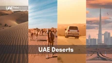
Geological Diversity: Deserts, Ophiolites, and Beyond
Ever walked from rust-red cliffs to golden dunes in a single day? The Emirates’ terrain feels like Earth’s greatest hits album—each track revealing a different geological era. From lunar-like ophiolite formations to undulating sand seas, this land whispers stories older than the Silk Road.
Let’s start with the rock stars—literally. Ophiolite complexes near Ras Al Khaimah are Earth’s crust turned inside out. These rare greenish rocks formed when ancient ocean floors got thrust upward like cosmic elevator doors. “It’s like finding a submarine in the desert,” laughs geologist Dr. Sara Al-Mazroui. “These formations help us map vanished seas.”
The Role of Ophiolite Complexes
These rocky time capsules contain clues about mantle composition and prehistoric plate movements. Hikers often spot chromite veins glittering in wadi walls—remnants of mineral-rich processes that shaped the region’s underground wealth.
Desert Landscapes Shaped by Ancient Processes
Abu Dhabi’s Empty Quarter didn’t just happen. Wind and water spent millennia rearranging sand grains into sculpted waves. Near Al Ain, fossilized dunes reveal how climate shifts locked sandy patterns in stone. The interplay between erosion and deposition creates ever-changing areas where new discoveries await.
Want to explore safely? Stick to marked trails in rocky zones—sudden drops hide behind photogenic ridges. For deeper insights into these diverse landforms, check local guides before venturing out. Remember: every grain and boulder here has a backstory worth respecting.
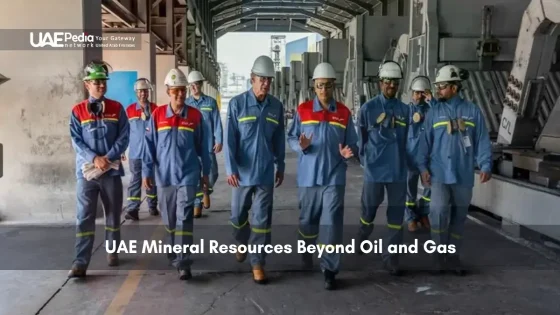
Natural Resources Tied to Tectonic Activity
What powers your car and charges your phone? The answer lies buried beneath layers of rock shaped by forces older than human history. The same geological processes that built jagged peaks also forged underground treasure chests of energy and minerals.
Energy Wealth From Ancient Earth Movements
Picture this: millions of years ago, shifting crust folded sedimentary layers like a cosmic pastry chef. These folds trapped organic material, creating perfect conditions for oil and gas formation. Along the Arabian Peninsula’s eastern margin, these geological wrinkles became natural storage tanks for hydrocarbons.
| Resource | Geological Origin | Key Locations |
|---|---|---|
| Oil | Compressed marine organisms in anticline structures | Abu Dhabi offshore fields |
| Natural Gas | Deep carbonate rock reservoirs | Shah Field |
| Gypsum | Evaporite deposits in ancient basins | Western desert regions |
From Rock Layers to Economic Powerhouse
The country’s energy sector owes its success to these underground architectures. “Every oil rig drills into a geological story,” notes energy analyst Mariam Al-Ketbi. “Fault lines that once caused earthquakes now guide engineers to reservoirs.”
Abu Dhabi’s skyline—and its sovereign wealth fund—stand testament to this resource wealth. Strategic investments in extraction tech ensure safe harvesting of these ancient deposits. Meanwhile, mineral-rich zones supply construction materials for growing cities.
- Limestone quarries feed cement plants along the coast
- Salt flats provide raw materials for chemical industries
- Groundwater reserves trace back to fractured rock formations
Next time you fill your gas tank, remember: you’re tapping into energy brewed by continental shifts over millennia. It’s Earth’s original slow-cooked recipe.
Future Directions in UAE Geological Research
Imagine cracking open Earth’s diary and finding blank pages waiting to be filled. That’s where we stand today—poised to decode tomorrow’s geological mysteries with tools sharper than a Bedouin’s falconry blade. Researchers now blend desert wisdom with quantum computing, creating a new playbook for understanding our dynamic landscapes.
Emerging Techniques in Tectonic Studies
Scientists in Abu Dhabi recently deployed laser-equipped drones to map fault lines with millimeter precision. These flying labs capture 3D models of rock formations faster than camels cross a dune field. Combined with AI that analyzes centuries of seismic data, they predict crustal shifts months before traditional methods spot trends.
- Quantum sensors detecting underground stress changes
- Virtual reality simulations of ancient plate collisions
- Citizen science apps crowdsourcing tremor reports
Climate Change and Its Impact on Geology
Rising temperatures aren’t just melting ice caps—they’re rewriting erosion patterns across desert ranges. A 2025 pilot project monitors how intensified rainfall reshapes wadis, using sensors that tweet real-time sediment data. “It’s like giving the land a voice,” says researcher Fatima Al-Marzouqi. “Every grain tells us how climate and geology dance together.”
Urban planners already use these insights. New coastal developments near the capital integrate flexible foundations designed for both rising seas and subtle crustal movements. The goal? Cities that adapt as gracefully as date palms swaying in the shamal winds.
Final Thoughts on a Dynamic Tectonic Environment
Every grain of sand here tells a story of slow-motion collisions and patient transformation. Over millions of years, the Arabian landmass has waltzed with neighboring plates, crafting valleys, cliffs, and hidden aquifers. This dance continues today—subtle shifts still tilt coastlines and lift ancient seabeds into desert ridges.
From Abu Dhabi’s gleaming towers to the Zagros Mountains’ distant shadows, the region’s identity stems from geological teamwork. Coastal plains shaped by subduction merge with salt flats formed through tectonic tilting, as outlined in recent studies. Even the Arabian Gulf’s azure waters hide clues to ongoing crustal adjustments beneath their surface.
As you explore, remember: these landscapes are Earth’s evolving sketchbook. Whether tracing fossil beds near Al Ain or hiking Hajar Mountain trails, tread with curiosity. Ready to decode more desert secrets? Dive deeper into the Emirates’ natural wonders with uaepedia.net—your guide to stories written in stone.
The Hajar Mountains formed when the Arabian Plate collided with the Eurasian Plate around 70 million years ago. This slow-motion crunch folded and uplifted ancient ocean sediments, creating jagged peaks visible today—like nature’s own origami project!
The plate’s northeast drift (about 2-3 cm yearly) shapes everything from oil-rich basins to earthquake risks. Think of it as Earth’s conveyor belt—slowly rearranging the Gulf’s landscapes and resources beneath our feet.
While rare, minor tremors do occur—especially near the Musandam Peninsula. Modern monitoring systems track seismic whispers 24/7, ensuring cities like Dubai and Abu Dhabi stay prepared without losing sleep over “big ones.”
These rare rock formations near Ras Al Khaimah are literal pieces of Earth’s mantle pushed upward during plate collisions. Geologists geek out over them—they’re like natural history museums showcasing the planet’s fiery underbelly!
The Makran Zone southeast of the Gulf drives sediment buildup along eastern shores. It’s why Fujairah’s beaches have that unique mix of minerals—a sandy reminder of tectonic teamwork between land and sea.
Absolutely! Plate movements created perfect traps for hydrocarbons over millions of years. Next time you fuel up, thank ancient continental collisions for those underground “pockets” of black gold.
From earthquake-resistant skyscrapers in Dubai to AI-powered seismic sensors, the Emirates blend Bedouin wisdom with cutting-edge tech. It’s like traditional falaj irrigation systems—but for tectonic safety!
Sand dunes hide secrets! Fossilized coral reefs in Abu Dhabi’s Empty Quarter whisper tales of ancient seas, while shifting sands map how wind and plate motions sculpted today’s apricot-hued landscapes.