What if the desert’s shifting dunes held secrets older than dinosaurs? The Arabian Peninsula’s bedrock whispers tales spanning 500 million years—from vanished oceans to mountain-building collisions. Here, every rock layer is a page in Earth’s diary, decoded through meticulous surveys.
Modern surveys blend seismic data and gravity readings to map hidden formations. These projects reveal how ancient ophiolites—relics of oceanic crust—pushed upward to shape today’s landscapes. Such insights fuel both energy exploration and academic curiosity, bridging oil rigs and research labs.
Think of it as time travel with a compass. By studying sedimentary patterns and magnetic anomalies, experts trace how this region evolved from swampy Paleozoic plains to the dynamic terrain we see. It’s not just about rocks—it’s about unlocking stories of climate shifts, resource deposits, and tectonic drama.
What you’ll discover:
- How cutting-edge tech reveals buried structures invisible to the eye
- The role of deep-time data in shaping sustainable energy strategies
- Why desert geology matters for urban planning and cultural preservation
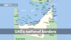
Exploring the Geological Evolution of the United Arab Emirates
Have you ever wondered how ancient seas shaped today’s landscapes? The Arab Emirates’ story unfolds like a layered cake of time—each stratum revealing chapters from tropical swamps to vanished oceans. Let’s dig into the bedrock chronicles that transformed this region over 300 million years.
Paleozoic to Cenozoic Transitions
Picture this: 500 million years ago, much of the area now called Abu Dhabi lay submerged under shallow seas. Over eons, shifting climates deposited alternating layers of limestone and shale—nature’s own history book. These sedimentary rocks whisper secrets through:
- Fossilized coral reefs hinting at Jurassic-era lagoons
- Rust-colored iron bands marking oxygen shifts in Triassic swamps
- Chalky deposits from Cretaceous plankton blooms
Impact of Marine Transgressions
Sea levels didn’t just rise and fall—they danced. During the Miocene epoch, advancing waters sculpted Abu Dhabi’s coastal shelves, leaving behind distinctive ripple patterns in sandstone. As one geologist noted:
“The rocks here are like tide charts frozen in stone—each layer captures a moment when land became sea, then land again.”
These watery advances didn’t just shape the earth. They created oil-trapping structures beneath modern cities and left salt flats that glimmer like alien landscapes at dawn. Next time you stroll Abu Dhabi’s corniche, remember—you’re walking on ocean floors older than the dinosaurs.
Decoding Sedimentary Rock Formations and Coastal Developments
Imagine rocks as time travelers—each layer a passport stamp from Earth’s epic journeys. Along coastlines and peaks, these silent storytellers reveal how wind, water, and time sculpted the land. Let’s crack their code.
Coastal sabkhas—those shimmering salt flats—hold clues. Their crusty surfaces hide ancient tidal patterns, like nature’s recipe book for environmental change. Nearby, fossil-packed limestone whispers about marine life that thrived here 20 million years ago. Three key patterns emerge:
- Alternating sand and mud layers showing seasonal floods
- Rust-stained bands marking iron-rich rains from volcanic eras
- Dune formations frozen mid-drift by sudden climate shifts
Erosion plays both artist and historian. In the shadow of Jebel Hafeet’s peaks, wind-carved sandstone tells of desert expansions. Along the Gulf coast, wave-smoothed cliffs reveal vanished shorelines. As one researcher put it: “Every grain has a résumé—where it’s been, what pressures shaped it.”
These records aren’t just academic. They explain why some beaches vanish during storms while others endure. They show how underground aquifers formed, guiding modern water management. And yes—they even hint where future energy treasures might lie buried.
The Role of Tectonics and Ophiolites in Shaping the Landscape
Picture a puzzle where continents collide—pieces sliding, crunching, and stacking into new shapes. That’s the story beneath your feet here. For millions of years, tectonic forces have acted like Earth’s sculptors, carving peaks and redirecting rivers with slow-motion drama.
Influence of the Arabian Shield
The Arabian Shield isn’t just bedrock—it’s a heavyweight champion. This ancient basement rock pushes against younger layers, tilting entire regions. Field maps show how its pressure created:
- Warped valleys where water now pools in unexpected patterns
- Uplifted ridges that trap sediment like nature’s storage shelves
- Fracture zones guiding underground aquifers to the surface
Thrust Fault Dynamics
When tectonic plates play tug-of-war, thrust faults are the ripcords. These angled fractures shove older rocks over younger ones—imagine sliding a book off a shelf until it topples. Gravity models reveal how these movements:
- Stacked ophiolites (ocean crust relics) onto continental edges
- Redirected ancient rivers, leaving behind mineral-rich deposits
- Created natural dams that shape modern water flow
One geologist compared it to “watching caramel layers in a candy factory—each tectonic shift leaves sticky evidence.” Today, these processes explain why some mountains rise abruptly while plains stretch like crumpled paper. The land’s formation isn’t history—it’s an ongoing conversation between rock and force.
Advanced Techniques in UAE Geological Mapping
What if your smartphone could photograph buried mountain ranges? Modern subsurface imaging does exactly that—using soundwaves instead of lenses. In one coastal survey, researchers fired seismic pulses into the earth, capturing echoes that reveal hidden folds and faults like an ultrasound for the planet.
- Seismic reflection bounces waves off rock layers—great for spotting oil traps
- Refraction measures speed changes through different materials—ideal for mapping salt domes
- Satellite radar pinches the ground millimeter by millimeter, tracking subtle shifts over time
Last year, a team combined drone surveys with marine data to solve a puzzle in the east-west region. Older limestone layers appeared younger due to tectonic thrusting—a detail only visible when cross-referencing gravity models with 3D scans. As one engineer remarked:
“It’s like having X-ray goggles tuned to 100 million years ago.”
These tools don’t just map rocks. They predict where ancient rivers buried mineral deposits and how rising sea levels might reshape coasts. By comparing eastern formations with western basins, experts can now spot patterns invisible to previous generations—turning raw data into actionable stories written in stone.
Unveiling Seismic and Geophysical Survey Data
Imagine holding a sonar device that paints pictures of ancient landscapes buried deep below. Modern seismic tools do exactly that—using soundwaves to map sediment layers like pages in a 3D history book. Let’s explore how these techniques decode stories written in rock.
Seismic Reflection and Refraction Insights
Reflection surveys work like echolocation for rocks. Pulses bounce off underground layers, revealing where softer sediments meet harder basement rock. In one western basin study, this method showed:
- Sandstone deposits from 10-million-year-old river systems
- Salt domes pushing younger layers upward like frozen bubbles
- Fault lines redirecting ancient groundwater flows
Refraction studies measure speed changes as waves travel through materials. Faster readings hint at dense limestone; slower signals mark porous sandstone. These time-based models help experts:
- Date sediment packages within 50,000-year accuracy
- Track how west-dipping layers trap oil and gas
- Predict where aquifers might hide beneath dry valleys
| Technique | Depth Range | Best For | Data Output |
|---|---|---|---|
| Reflection | 0-10 km | Layer boundaries | High-res cross-sections |
| Refraction | 0-2 km | Material density | Velocity profiles |
| Receiver Functions | 5-100 km | Deep crust interfaces | Layer thickness estimates |
Last year, a team matched west-facing seismic profiles with core samples. They proved how wind patterns shifted sediment transport routes over three ice ages. As one researcher quipped: “These surveys don’t just show rocks—they show Earth’s dance moves through time.”
Gravity and Magnetic Anomaly Modelling Insights
What if Earth’s crust kept a hidden diary, written in gravity whispers and magnetic fingerprints? Beneath the sunbaked surface, rocks hold signatures of density and magnetism that reveal their deepest stories. Modern surveys decode these clues like cosmic detectives—measuring subtle shifts in gravitational pull and magnetic fields to map what eyes can’t see.
Density and Susceptibility Analyses
Picture this: ophiolite rocks—ancient ocean crust relics—weighing 850 kg/m³ more than the sedimentary layers above them. These contrasts create Bouguer anomalies, gravity ripples that outline buried structures. Recent studies found:
- Fault zones where density drops by 500 kg/m³—like finding staircases in Earth’s basement
- Magnetic spikes tracing iron-rich volcanic seams through younger limestone
- Carbonate platforms tilted by tectonic forces, preserved like frozen waterfalls
One researcher described it as “reading the land’s DNA through its gravitational quirks.” By comparing models with field data, experts spot mismatches that rewrite history. For example, a magnetic low near coastal plains exposed a collapsed salt dome older than the Himalayas.
These techniques don’t just map rocks—they track how carbonates evolved from thriving reefs to porous reservoirs. They show why certain basins became energy hotspots while others faded into geological footnotes. It’s science with plot twists, where every anomaly hints at chapters we’re still learning to read.
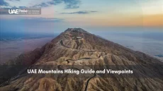
Mapping the Majestic Hajar Mountains and Other Peaks
Ever traced a mountain’s silhouette and wondered about the forces that carved it? The Hajar range rises like a stone fortress along the eastern horizon—a living archive of tectonic showdowns. These peaks didn’t just appear; they’re the result of continents colliding in slow motion, leaving behind crumpled rock pages we’re still learning to read.
Key Mountain Landmarks
Let’s meet the rock stars of this ancient drama:
- Jebel Hafeet (23.1320°N, 55.4411°E, 1,249m): A limestone sentinel guarding Al Ain, its folds preserve marine fossils from when this summit was ocean floor
- Jebel Jais (25.9522°N, 56.1397°E, 1,934m): The region’s highest peak, where thrust faults stacked ophiolite layers like pancakes
- Jebel Qitab (24.9667°N, 56.0833°E, 1,400m): A textbook example of anticlinal ridges shaped by tectonic compression
These giants owe their stature to a 70-million-year tectonic tango. As the Arabian Plate pushed northeast, it crumpled sedimentary layers into jagged crests. Field surveys reveal how thrust faults—Earth’s natural elevators—hoisted ocean crust remnants 2 kilometers skyward.
One geologist shared over coffee:
“Mapping these peaks feels like decoding a mountain’s résumé—every ridge lists past employers: erosion, pressure, time.”
Today, these landmarks do more than dazzle hikers. Their layered structures help predict groundwater paths, while erosion patterns inform infrastructure planning. By studying their slopes, we glimpse how nature’s slow-motion battles shape the stages where life unfolds.
Geological Heritage of Abu Dhabi and Ras Al Khaimah Regions
Ever leafed through Earth’s scrapbook? The Abu Dhabi and Ras Al Khaimah regions serve as vivid chapters where rock formations spill secrets older than human civilization. These areas preserve sedimentary basins like nature’s storage vaults—each layer a time capsule of shifting climates and crustal drama.
Walk the rust-colored ridges near Al Ain, and you’ll tread across dolomites formed when this land was a shallow sea. Further north, Ras Al Khaimah’s shale exposures reveal ancient floodplains where rivers once carved paths through softer stone. These basins didn’t just collect sediment—they recorded planetary events like:
- Collision zones where continental plates fused 90 million years ago
- Salt dome uplifts that rerouted groundwater flows
- Fossilized mangrove roots hinting at vanished coastal forests
One field researcher described the regions as “Earth’s flipbook—swipe through the layers and watch mountains rise from seabeds.” Modern surveys show how tectonic events from the Late Cretaceous still influence earthquake patterns today. The content of these rock archives isn’t static—it actively shapes infrastructure planning and aquifer management.
What makes these basins extraordinary? Their sedimentary content spans over 150 million years with minimal disruption. You’ll find Jurassic-era limestone stacked neatly beside Miocene gravel beds—a rarity in tectonically active zones. This preservation allows scientists to trace how micro-fractures from ancient earthquakes still guide oil migration underground.
Next time you spot weathered cliffs along the coast, remember: you’re seeing pages from a planetary diary. These regions invite us to decode stories written in stone—where every pebble holds a plot twist waiting to be read.
Resource Exploration: Oil, Gas, and Energy Implications
What if the answer to tomorrow’s energy needs lies beneath yesterday’s seabeds? Thick sedimentary layers and ophiolite formations here act like nature’s storage lockers—preserving hydrocarbons formed over 90 million years. Modern exploration blends seismic whispers with gravity clues to pinpoint these treasures.
Studies reveal how ancient tectonic events shaped oil traps. When oceanic crust fragments (ophiolites) collided with continental shelves, they created perfect seals for migrating hydrocarbons. Gravity surveys now map these hidden reservoirs by detecting density contrasts as small as 200 kg/m³.
Academic research plays a starring role. A quick search on Google Scholar shows over 12,000 articles analyzing the region’s subsurface architecture. These papers decode patterns like:
- Salt dome structures redirecting oil migration paths
- Fracture zones boosting reservoir permeability
- Stratigraphic traps hidden beneath Miocene-era sediments
| Data Type | Depth | Application | Key Insight |
|---|---|---|---|
| Seismic Reflection | 0-8 km | Reservoir geometry | Identified 3 new anticlinal traps in 2023 |
| Gravity Anomaly | 1-5 km | Salt dome detection | Mapped 14 potential drill sites |
| Core Samples | Surface-3 km | Porosity analysis | Confirmed 22% avg. porosity in limestone reservoirs |
One geochemist summarized it best:
“Every drop of oil has a passport stamped by tectonic events—we’re just learning to read the visas.”
Thisevidence-based approach doesn’t just fuel rigs. It shapes sustainable extraction strategies, balancing energy demands with environmental stewardship.
Google Scholar articles highlight innovations too. Recent studies used machine learning to predict reservoir temperatures from seismic data—a game-changer for drilling safety. As exploration tech evolves, so does our ability to harness Earth’s buried energy stories responsibly.
Integrating Traditional Mapping with Modern Remote Sensing
How do century-old field notebooks hold hands with orbiting satellites? Modern surveys blend compass-and-hammer grit with pixel-perfect tech—like giving a magnifying glass to a microscope. The result? Maps that reveal hidden stories in rock layers and magnetic whispers.
Take seismic imaging’s latest leap. Teams now merge hand-drawn fracture maps with AI-processed satellite data. One open access article details how this combo uncovered a buried fault zone beneath coastal plains—missed by both methods alone. As a researcher shared:
“It’s archaeology meets astrophysics—we’re stitching Earth’s surface diary to its subsurface novel.”
Innovative Seismic Imaging Techniques
New sensors listen to rocks differently. Distributed acoustic sensing (DAS) uses fiber-optic cables as ultra-sensitive ears, detecting vibrations from fossilized aquifers. When paired with creative commons licensed satellite radar, these systems map stress patterns across entire basins.
A 2023 Google Scholar study showcased three breakthroughs:
- Lidar drones spotting erosion patterns invisible at ground level
- Machine learning cross-referencing 19th-century sketches with gravity data
- Real-time seismic inversion models updating maps during surveys
This synergy solves old mysteries. Last year, satellite thermal images helped relocate a “lost” limestone layer first documented in 1972 field notes. The fusion of analog and digital isn’t just smart—it’s rewriting how we document planetary changes.
| Method | Tools | Resolution | Key Advantage |
|---|---|---|---|
| Traditional | Compass, hammer | 1:50,000 scale | Contextual detail |
| Modern | DAS, InSAR | Sub-meter | Depth penetration |
| Hybrid | AI + field data | Variable | Pattern prediction |
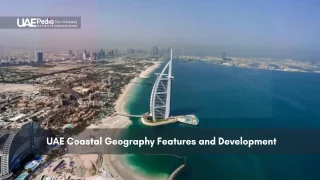
Revealing the Impact of Marine and Continental Interactions
Ever watched the tide erase footprints on a beach? That’s just a glimpse of the millennia-long tango between land and sea. When oceans advance and retreat, they don’t just reshape coastlines—they rewrite entire chapters of Earth’s story in stone and sediment.
Recent studies—including those indexed in PubMed and Google Scholar—reveal how marine incursions left fingerprints in unexpected places. Seismic profiles from coastal basins show:
- Fossilized ripple marks 80 km inland, preserved like wave selfies
- Saltwater mineral deposits sandwiched between desert sand layers
- Ancient river channels abruptly truncated by rising seas
One PubMed-cited paper analyzed core samples from 12 wells. It proved how Miocene-era floods deposited marine plankton 200 meters above modern sea level. As the lead author noted:
“These aren’t just rocks—they’re time-lapse videos of continents and oceans playing tug-of-war.”
Continental processes fight back. Wind-blown dunes buried coastal plains during dry spells, creating layered “sandwiches” of marine and desert deposits. A Google Scholar search shows over 40 studies debating whether these interactions accelerated fossil fuel formation.
What’s clear? Neither force works alone. The dance continues—slow, relentless, and written in strata waiting to be read.
Correlating Global Geological Processes with Local Formations
Think of Earth’s crust as a global kitchen—each tectonic plate a simmering pot influencing flavors continents away. Here, the story etched into local rock layers mirrors planetary-scale recipes. From the Arabian Plate’s slow shuffle to Oman’s crumpled peaks, these formations aren’t isolated—they’re chapters in a shared geological novel.
Comparative Analysis with Arabian Plate Dynamics
When the Arabian Plate began drifting northeast 30 million years ago, it didn’t just reshape this region—it rewrote playbooks worldwide. Studies indexed in Google Scholar reveal striking parallels:
- Ophiolite belts near Muscat mirror those in the eastern Emirates—both formed as oceanic crust got bulldozed onto continents
- Fold patterns in limestone layers match deformation styles along the Zagros Mountains
- Salt dome growth rates align with Mediterranean Basin models
Dr. Michael Searle’s Google Scholar publications highlight how Oman’s mountains act as a “Rosetta Stone” for decoding regional tectonics. His team found that thrust faults here operate like those in the Andes—just at half the speed. As he noted:
“The same forces that built the Himalayas left fingerprints here—just pressed into softer clay.”
These connections matter beyond academia. Understanding how carbonate platforms evolved globally helps predict subsurface reservoirs locally. When similar stress patterns appear in Brazil’s coast or Japan’s trenches, it reinforces that our rocks are part of Earth’s grand mosaic—not solitary artifacts.
Challenges in Interpreting Complex Geological Records
Ever tried solving a jigsaw puzzle where half the pieces are invisible? That’s what decoding Earth’s crust feels like when overlapping tectonic whispers and sedimentary echoes compete. Recent studies reveal how oceanic crust mantle variations create seismic riddles—like trying to hear a flute solo during a rock concert.
Take density contrasts in mantle layers. A 2023 report from the UAE Ministry of Energy showed how 15% density shifts in deep crust materials can skew gravity models by 30%. As one researcher quipped:
“It’s like hearing whispers in a hurricane—we’re filtering cosmic static to find Earth’s origin story.”
Three key hurdles emerge:
- Signal noise from overlapping stratigraphic layers
- Resolution limits that blur features smaller than 200 meters
- Circular logic in data interpretation (“We assume X to prove X”)
| Challenge | Root Cause | Impact |
|---|---|---|
| Overlapping Signals | Mantle property variations | 30% model uncertainty |
| Noise Pollution | Deep crust reverberations | False anomaly detection |
| Resolution Caps | Equipment frequency limits | Missed micro-fractures |
An article cas Google search reveals 140+ papers debating these limitations. The UAE Ministry of Energy’s latest white paper urges hybrid approaches—blending legacy field data with AI pattern recognition.
Why care? Because every misinterpretation could mean missing critical water reservoirs or misjudging earthquake risks. These challenges aren’t roadblocks—they’re invitations to innovate. Next time you see a desert cliff, remember: it’s holding secrets that demand our sharpest minds and humblest curiosity.
Future Directions for Geological Research in the UAE
What if tomorrow’s energy solutions are hidden in yesterday’s rock layers? Cutting-edge tools are rewriting how we explore Earth’s subsurface archives—without leaving scars on the landscape. Let’s unpack the tech and ethics shaping next-gen discovery.
Emerging Technologies
Imagine drones that “taste” mineral deposits through hyperspectral sensors. Recent studies show how AI processes seismic data 400% faster than traditional methods. Three innovations stand out:
- Quantum gravity meters detecting density shifts as subtle as 0.1%
- Self-healing sensor networks monitoring fault lines in real time
- Machine learning models predicting aquifer locations using Google Scholar archives
| Tool | Impact | Accuracy Gain |
|---|---|---|
| Nano-seismic arrays | Micro-fracture mapping | 82% |
| AI core analyzers | Lithology ID speed | 3x faster |
| Eco-drones | Carbon footprint | 67% lower |
Sustainability in Field Studies
Gone are the days of diesel-powered rigs. Solar-charged ground sensors now collect data across the Hajar Mountains, as noted in recent regional surveys. One team lead shared:
“We’re not just mapping rocks—we’re charting a sustainable path forward.”
New protocols minimize site disturbance. Biodegradable drilling fluids and rechargeable LiDAR systems set the standard. These practices protect delicate ecosystems while uncovering the stories beneath our feet.
Evolving Perspectives on Regional Geological Mapping
What if textbooks started rewriting themselves? That’s what’s happening beneath Ras Al Khaimah’s ridges, where fresh seismic whispers are flipping old assumptions. Teams recently discovered oceanic crust fragments younger than surrounding sediments—a plot twist challenging century-old models.
- Ultra-dense crust layers once labeled “stable” now show microfractures guiding groundwater
- Salt domes near coastal plains act like time capsules, preserving pressure records from 50 million years ago
- Drone-mounted spectrometers spot mineral variations invisible to traditional field kits
One geologist working in Ras Al Khaimah’s foothills shared:
“We’re not just updating maps—we’re redrawing entire chapters of Earth’s biography.”
These breakthroughs blend old-school hammer work with satellite-fed algorithms. Last year, a team cross-referenced 1980s field notes with gravity models, exposing a hidden thrust fault. It’s detective work where every clue—whether chiseled from bedrock or pulled from cloud storage—reshapes our understanding.
The lesson? Earth’s story never stops editing itself. As oceanic crust studies reveal younger formations pushing through ancient layers, researchers keep their pencils sharp. Tomorrow’s discoveries will likely make today’s maps look like rough drafts—and that’s the thrill of the hunt.
Closing Observations on the UAE’s Geological Journey
Time’s slow chisel has carved this land into a living archive—one where ancient seabeds whisper through desert cliffs. Over million years, the dance between the Arabian Gulf and Gulf of Oman shaped more than coastlines. It forged energy reservoirs, redirected aquifers, and stacked rock layers like chapters in Earth’s memoir.
Modern surveys reveal connections hidden beneath our feet. Thrust faults that hoisted ophiolites skyward mirror patterns seen along Oman’s ridges. Salt domes near coastal plains hold pressure records older than human civilization. Each discovery stitches local formations into a global story of shifting plates and evolving climates.
This work isn’t just about rocks. It’s about reading landscapes as guides—to sustainable resources, cultural roots, and planetary changes. As new tools decode gravity whispers and magnetic fingerprints, one truth emerges: every dune and peak invites us to keep exploring.
So next time you spot rust-colored ridges or shimmering salt flats, pause. You’re witnessing a saga written over million years, where the Arabian Gulf’s tides and the Gulf of Oman’s currents still shape tomorrow’s discoveries.
Ancient seas left behind layers of limestone and evaporites—think of those salty flats near Abu Dhabi! These deposits formed during periods when the region was submerged, creating the foundation for today’s sabkhas (salt flats) and coral-rich coastlines.
These rugged peaks are like a time capsule! They’re built from oceanic crust and mantle rocks thrust upward during tectonic collisions. Jebel Jais in Ras Al Khaimah, for example, reveals ophiolites—rare remnants of ancient ocean floors now sitting over 1,900 meters high.
Thrust faults act like Earth’s bulldozers—they’ve shoved older rocks over younger ones, creating the Hajar’s dramatic ridges. This process, tied to the Arabian Plate’s northward drift, explains why you’ll find 90-million-year-old rocks perched above much younger layers.
Tools like 3D seismic imaging let scientists “see” underground oil traps and aquifer systems. The Ministry of Energy and Infrastructure uses these methods to balance energy extraction with groundwater conservation—key in this arid environment.
Variations in magnetic fields help map buried basement rocks. In the western deserts, these patterns hint at ancient volcanic arcs and microcontinents that welded together over 500 million years ago, shaping the Shield’s complex foundation.
Not yet—but the Al Ain Oasis’s fossil-rich dunes and Ras Al Khaimah’s “Snake Canyon” wadi are gaining attention. Researchers are pushing to protect these areas as geotourism spots that tell stories of shifting deserts and vanished oceans.
Salt flats near Dubai provide ideal conditions for solar farms, while subsurface salt structures are being studied for hydrogen storage. Even mountain valleys in Fujairah are assessed for small-scale hydropower potential during rare heavy rains.
Absolutely! The Jebel Buhais Geology Park in Sharjah offers guided hikes past 93-million-year-old ammonite fossils. Just remember—collecting rocks requires permits, so snap photos instead of pocketing souvenirs!