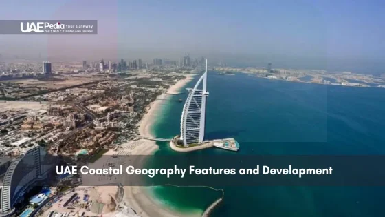
Did you know 80% of the united arab emirates’ population lives within 50 miles of its shimmering coastlines? This desert nation’s 1,300 km of shoreline along the Persian Gulf and Gulf of Oman isn’t just pretty beaches—it’s the lifeblood connecting ancient trade routes to today’s futuristic cities.
We’ll walk you through how this country’s unique geography shaped everything from pearl diving traditions to palm-shaped islands. You’ll discover why the capital Abu Dhabi sits where it does, how an area spanning 83,600 km² packs in mangrove forests and luxury resorts, and what makes these overlapping worlds so fascinating.
Think of it like Dubai’s skyline meeting the Arabian Sea—a place where camels still trot near yacht marinas. Whether you’re planning a trip or just curious, we’ve got the insider angles most travel guides miss.
Key takeaways:
- Coastal zones drive economic growth while preserving Bedouin heritage
- Strategic location makes the region a global crossroads
- Diverse ecosystems thrive between arid landscapes and turquoise waters
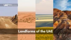
Understanding the UAE Coastal Landscape
Picture this: jagged mountain ridges tower over salt-crusted plains that melt into turquoise waters. The nation’s 1,318 km shoreline—split between the Persian Gulf and Gulf of Oman—isn’t just sand. It’s a living map where geology meets human ambition.
Geographical Overview and Topography
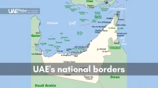
Western Hajar’s rust-colored peaks (reaching 1,934 meters) guard the eastern edges, while Abu Dhabi’s low-lying islands anchor the west. This federation’s seven emirates showcase:
- Rocky desert plateaus that crunch underfoot like stale bread
- Salt pans shimmering like shattered mirrors under midday sun
- Smooth sabkha flats where land and sea play tug-of-war
Abu Dhabi—the capital emirate—sits just 140 km from Saudi Arabia’s border. Its strategic position shaped oil extraction methods, with pipelines snaking from inland reserves to Persian Gulf ports.
Climate and Environmental Conditions
Summer thermometers here don’t whisper—they shout. Dubai’s August average hits 41°C (106°F), while January brings a mild 24°C (75°F). Yet microclimates exist:
| Location | Summer High | Winter Low |
|---|---|---|
| Abu Dhabi | 43°C | 18°C |
| Fujairah Coast | 38°C | 22°C |
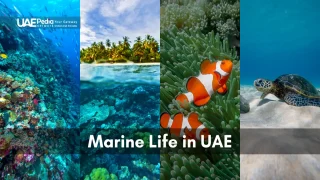
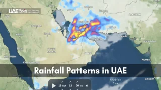
As a geologist friend once told me over karak chai: “These extremes forged the land—scorching winds bake the desert, while winter shamals sculpt dunes like nature’s pottery wheel.” Offshore, warm Gulf waters nurture coral reefs that defy the arid logic above.
Exploring UAE Coastal Geography: Unique Features and Natural Resources
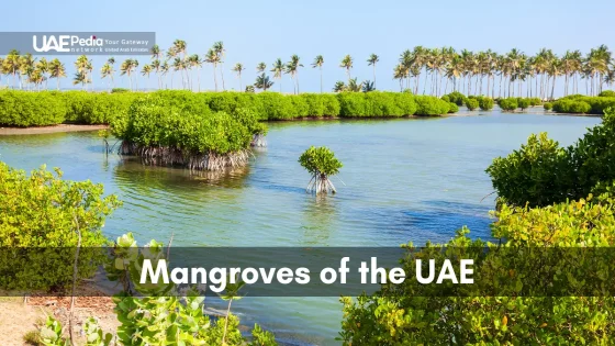
Ever stepped on ground that crackles like breakfast cereal underfoot? That’s the magic of the sabkha—salt flats where evaporated seawater leaves intricate crystal patterns. These natural mosaics stretch across 637 km² of tidal zones, ranking among Earth’s most vital habitats for migratory birds.
Now look west. Dubai’s Jebel Ali port—the largest human-made harbor on the planet—handles cargo for 180+ shipping routes. Abu Dhabi’s Khalifa Port spans 8.4 km², while Sharjah’s Khor Fakkan juggles 4 million containers yearly. Together, these hubs anchor the nation’s non-oil trade, which hit $1 trillion in 2022.
But here’s the twist: the seven emirates balance industrial might with ecological care. As marine biologist Noora AlHbabi shared: “Our tidal flats filter seawater naturally—like kidneys for the Gulf. Protecting them means cleaner fisheries and healthier mangroves.”
Challenges? Oh yes. Summer heatwaves test port machinery, while rising sea levels threaten low-lying areas. Yet this desert-meets-ocean region keeps innovating—solar-powered desalination plants now dot the shoreline, turning sand and sun into fresh water.
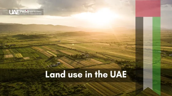
With 83,600 km² total area (about Maine’s size), the land hosts both flamingo-dotted wetlands and AI-managed container yards. It’s why travelers find fjord-like coves in Fujairah just hours from Dubai’s robotic cranes—a middle east paradox where nature and ambition share sunscreen.
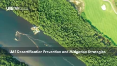
Human Impact and Coastal Development Initiatives
Imagine waking up to a sunrise that paints skyscrapers gold while robotic drones plant mangroves below. This isn’t sci-fi—it’s today’s shoreline reality where crude oil profits fund AI-driven green cities. Since 2010, non-oil sectors grew from 38% to 72% of GDP, reshaping 32,300 square miles of desert-meets-sea terrain.
Economic Diversification Beyond Oil
Fishing dhows now share waters with floating solar farms near the Musandam Peninsula. Tourism revenue hit $29.4 billion in 2023—triple 2015 figures—with projects like Hatta’s mountain resorts leveraging the highest point (Jabal Yibir) for adventure tourism. A port director once joked: “We trade oil barrels by day and starlight glamping tents by night.”
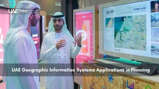
Urban Expansion and Technological Innovation
Dubai’s 2040 plan carves “20-minute cities” along transit corridors, while Fujairah’s smart ports at the Strait of Hormuz use blockchain for 30% faster customs. Developers face unique puzzles: how to build luxury towers on salt flats or route hyperloops around land boundaries. As one engineer told me: “We 3D-print coral reefs now—construction adapts to nature here.”
According to a maritime development study, 73% of recent projects blend traditional Arabic design with carbon-neutral tech. The result? Cities where wind towers cool futuristic souks, proving deserts and data centers can coexist.
Historical Influences and Maritime Heritage
What do 19th-century pearl divers and modern shipping magnates have in common? Both navigated waters where ancient dhows once carried frankincense, and today’s mega-tankers transport global goods. The story of this desert-meets-sea federation began with rival sheikhdoms guarding islands and borders along trade routes stretching thousands of miles.
From Trucial Sheikhdoms to Modern Federation
In 1820, British envoys brokered peace among warring clans along the Persian Gulf’s southern shore—birth of the “Trucial States.” These agreements transformed pirate havens into protected ports. By 1971, six emirates united under one flag (Ras Al Khaimah joined later), creating a federation that leveraged its economy around strategic waterways.
| Treaty | Year | Key Impact |
|---|---|---|
| Perpetual Maritime Truce | 1853 | Ended naval conflicts between sheikhdoms |
| Exclusive Agreement | 1892 | Established British protection of trade routes |
| Union Agreement | 1971 | Formed modern federation with defined borders |
Strategic Maritime Routes and Disputes
Control over the Strait of Hormuz—a 21-mile-wide chokepoint—sparked centuries of rivalry. Disputes over islands like Abu Musa and the Tunbs nearly boiled over in the 1970s. “Control over islands meant control over trade lanes—these specks of land shaped empires,” explains historian Dr. Amina AlFalasi.
Today, the federation’s size and location let it manage 30% of global oil shipments. Yet traditions endure: Dubai’s Creek still hosts wooden abras ferrying traders, mirroring routes mapped by 16th-century Portuguese explorers. It’s a living museum where GPS-guided ships sail past watchtowers that once guarded pearl beds.
Final Reflections on Coastal Growth and Future Prospects
Ever watched a desert sunrise while cargo ships glide by like floating cities? This blend of ancient sands and tomorrow’s tech defines the nation’s shoreline story. Balancing petroleum heritage with green innovation, leaders now invest in solar-powered gas plants and AI-managed oases—proving deserts can fuel both tradition and progress.
Smart ports along strategic borders now use blockchain to slash emissions, while eco-friendly ship designs reduce maritime disputes over fragile areas. A recent report notes the maritime sector’s evolution could add $30 billion to the economy by 2030 through carbon-neutral operations and automated logistics.
But growth isn’t just about scale—it’s soul. Well-preserved tidal flats still host flamingos, while restored date palm groves frame hyperloop stations. As one engineer grinned: “We’re building cities that breathe.”
The rest of this dynamic region invites you to explore its contrasts. Imagine sipping karak tea where robot gardeners tend mangrove nurseries, or hiking wadis that echo with both goat bells and drone propellers. This isn’t just development—it’s a masterclass in harmonizing ambition with nature’s rhythms. Ready to see tomorrow’s skyline taking shape today?
The seven emirates evolved from pearl-diving hubs and trading ports along the Persian Gulf. Their strategic locations fueled commerce, creating cultural crossroads that later became modern powerhouses like Dubai and Abu Dhabi.
This narrow waterway connects the Persian Gulf to the Indian Ocean, making it a global chokepoint for crude oil shipments. Over 20% of the world’s petroleum passes through here, directly impacting the Emirates’ economy and geopolitical role.
Blistering heat, shifting sand dunes, and limited freshwater strain ecosystems. Mangroves and coral reefs near places like Fujairah act as natural barriers, but urban expansion and industrial activity require careful balancing with conservation efforts.
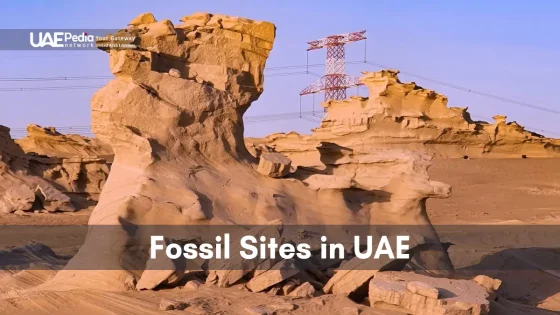
Absolutely! The Hajar Mountains stretch into Oman, with Jabal Yibir reaching 1,527 meters. These rocky peaks contrast sharply with tidal flats and islands, offering hiking trails and ancient fossil sites just hours from Dubai’s skyscrapers.
Sabkha (salt flats) like those near Abu Dhabi now drive renewable energy projects. Solar farms harness reflective surfaces, while researchers study extremophile microbes here for biotech breakthroughs—turning ancient landscapes into innovation labs.
Often called the “Norway of Arabia,” this exclave features fjord-like khors (inlets) carved into limestone cliffs. Dhows still navigate these waters, blending Omani heritage with Emirati modernization in a remote, drama-filled landscape.