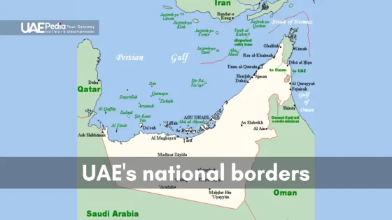
What if we told you a single country holds 1,300 km of coastline alongside peaks reaching 1,900 meters? The United Arab Emirates isn’t just skyscrapers and golden dunes—it’s a living geology exhibit where jagged limestone ridges whisper ancient secrets and turquoise waves polish fossil-rich shores.
This land’s dramatic contrasts—the Hajar Mountains’ rocky spine cutting through eastern horizons, Abu Dhabi’s salt flats dissolving into warm seas—shape everything from ecosystems to traditions. Bedouin tribes once navigated by these formations, while modern adventurers hike wadis carved by millennia of flash floods.
You’ll find stories etched in sandstone: coral reefs turned to stone, dunes that sing in the wind, and salt caves hiding beneath the surface. These landscapes aren’t just backdrops—they’re active characters in the Emirates’ natural history, influencing architecture, trade routes, and even local folklore.
Here’s what you’ll uncover ahead:
- How tectonic collisions built the Hajar range 70 million years ago
- Coastal ecosystems where desert meets the Arabian Gulf
- Geotourism gems beyond the usual tourist trails
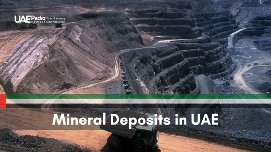
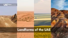
Overview of the UAE Geological Landscape
From rocky highlands to shimmering coasts, the United Arab Emirates packs four distinct regions—each with its own geological fingerprint. You’ll find salt-crusted sabkha flats hugging the Arabian Gulf, endless dunes in the Empty Quarter, and the Hajar Mountains’ rust-colored peaks guarding the east.
Let’s unpack what makes each area unique. The western third reveals Abu Dhabi’s sprawling sand seas—giant dunes shaped by relentless winds. Central plains transition into fertile land near Al Ain, a hallmark of the Arab Emirates’ varied geology. Meanwhile, the eastern edge offers rugged wadis carved into limestone over millennia.
What surprises first-time explorers? Many of these diverse landforms sit minutes from cities. You can crunch across gypsum crystals in Al Wathba’s fossil-rich plains before lunch, then hike 1,900-meter Jebel Jais by sunset. It’s this accessibility—paired with stark beauty—that turns casual visitors into geology enthusiasts overnight.
The Natural History of UAE’s Changing Terrains
Imagine flipping through Earth’s photo album—each page reveals dramatic makeovers of what we now call the Emirates. Over 250 million years, colliding continents, retreating oceans, and shifting dunes sculpted this land into its current form. Wind-polished cliffs and fossilized coral reefs? They’re not just scenery—they’re chapters in a planetary story.
Evolution Over Time
Picture the Hajar Mountains as newborn peaks 70 million years ago—raw and jagged from tectonic collisions. Flash floods later carved intricate wadis, while desert winds sandblasted bedrock into curves. “Every canyon here is a timeline,” notes Emirati geologist Dr. Ahmed Al-Hosani. “Episodic flooding writes new verses in these stone journals.”
Key Environmental Milestones
Ice Age sea level drops 20,000 years ago exposed vast coastal plains, forcing species to adapt or vanish. Mangroves retreated, while hardy acacias thrived in salt-tinged soils. Today’s study of sediment layers reveals ancient pollen grains—tiny time capsules showing how ecosystems danced with climate shifts.
Walk a dry wadi bed, and you’re tracing paths shaped by millennia of sudden storms. These natural highways once guided nomadic tribes and now lure hikers seeking Earth’s unfinished artistry. How’s that for a history lesson written in sand and stone?
Geological Divisions Shaping the Emirates
Picture a puzzle where each piece tells a different Earth story—that’s the Emirates’ landscape. Four distinct units form its foundation: salt-kissed coasts, restless deserts, mountain spines, and fertile plains. Let’s explore how these zones interact like characters in nature’s play.
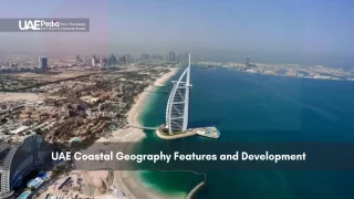
Coastal Plains and Sabkhas
The western shoreline along the Arabian Gulf hides one of Earth’s weirdest art studios. Sabkhas—salt flats where seawater evaporates—create crackled patterns resembling abstract paintings. These flats aren’t just pretty. They preserve ancient climate records in their mineral layers.
Walk here at low tide, and you’ll spot crabs darting between tidal pools. Mangroves fringe lagoons, their roots filtering saltwater. It’s a living lab where desert meets ocean, shaping unique habitats found nowhere else.
Sand Deserts and Alluvial Plains
Head inland, and dunes rewrite their contours daily. Winds sculpt sand dunes into crescent shapes called barchans, some taller than 10-story buildings. But between these golden waves lie surprises—floodplains where sudden rains transform elevation variations into temporary oases.
Wadis (dry riverbeds) act as nature’s highways. After storms, water rushes through these channels, nourishing acacia trees and providing drinking spots for gazelles. This interplay of land types creates micro-ecosystems that sustain life in harsh conditions.
Together, these divisions form a living mosaic. Next, we’ll scale the Hajar Mountains—where tectonic drama meets modern adventure.
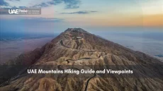
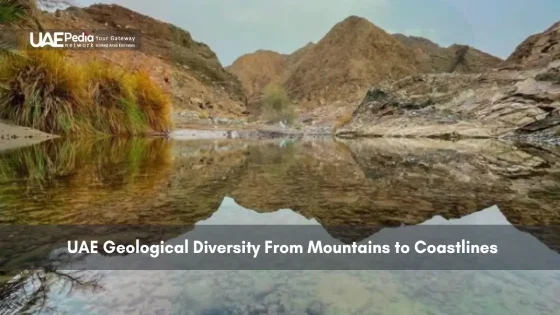
The Majesty of the Hajar Mountains
Ever wondered where you can walk on pieces of Earth’s ancient ocean floor? The Hajar Mountains rise like stone sentinels along the eastern edge of the country, their rust-colored peaks hiding secrets from 95 million years ago. These aren’t ordinary mountains—they’re geological time capsules formed when oceanic crust collided with continental plates.
Formation and Ophiolite Origins
Picture this: sections of Earth’s mantle now sit exposed at Jebel Hafeet’s base. These ophiolite rocks—once part of the deep seafloor—reveal clues about tectonic forces that shaped the region. “It’s like reading Mother Nature’s diary,” says field geologist Layla Al-Mansoori. “These rocks traveled 50 kilometers upward to become today’s hiking trails.”
Steep slopes create microclimates where wild figs cling to cliff faces. Wadis snake through valleys, their terraces hosting rare plants adapted to thin soils. The table below shows how these features interact:
| Feature | Description | Significance |
|---|---|---|
| Ophiolite Rocks | Ancient oceanic crust | Reveal mantle composition |
| Steep Slopes | 60°+ inclines | Create rain shadows |
| Fossilized Coral | Petrified reefs | Indicate past sea levels |
Early Bedouin travelers navigated these ridges using star patterns and rock formations. Today’s adventurers find the same routes transformed into via ferrata climbing paths. Whether you’re tracing fossil beds or spotting Arabian tahr goats, these mountains remind us that nature writes its history in stone—one tectonic shift at a time.
Coastal Wonders: From Mangroves to Rocky Headlands
Ever dipped your toes where desert sands meet turquoise waves? The Arabian Gulf coastline stitches together a wild tapestry—serene mangrove nurseries, fossil-studded cliffs, and tide pools teeming with life. Here, the sea doesn’t just kiss the shore—it shapes entire ecosystems through salt and sediment.
Walk Abu Dhabi’s Eastern Mangroves, and you’ll crunch seashells underfoot while herons glide between tangled roots. These forests aren’t just pretty—they’re Earth’s shock absorbers. “Mangroves reduce wave energy by 75%,” notes marine biologist Dr. Amal Khalid. “Their roots trap sediment, building new land while sheltering juvenile fish.”
Head northeast, and the scene shifts. Rocky headlands near Fujairah plunge into deep waters, their limestone layers recording millennia of marine life. Tide pools here become micro-galaxies at dawn—anemones bloom crimson, ghost crabs skitter, and ancient coral fossils peek through eroded stone.
| Feature | Location | Role |
|---|---|---|
| Mangrove Forests | Abu Dhabi | Erosion control, biodiversity |
| Coral Reefs | Eastern Coast | Marine habitat, tourism |
| Rocky Headlands | Northern Emirates | Wave barriers, fossil records |
Coastal wadis add another twist. After rare rains, these dry channels funnel freshwater to the shore, creating temporary estuaries where gazelles drink alongside flamingos. It’s a reminder that even in arid climates, land and sea conspire to sustain life.
These shores aren’t just postcard backdrops—they’re living classrooms. Whether you’re kayaking through mangrove tunnels or hunting fossils on wave-battered cliffs, the United Arab Emirates coast proves deserts and oceans write equally compelling stories. Ready to feel salty breeze on your skin?
Insights into UAE Geological Diversity: A Comprehensive Exploration
How does a landscape hold both fossilized coral and singing sand dunes? This corner of the Arabian Peninsula serves as Earth’s open-air laboratory—where salt flats preserve ancient climates and mountain peaks reveal mantle rocks from vanished oceans. Every ridge and wadi whispers secrets about our planet’s restless nature.
Let’s connect the dots. The Hajar Mountains’ ophiolite formations—once submerged seabed—now help scientists study tectonic collisions that shaped continents. Coastal sabkhas act as natural archives, trapping mineral layers that track sea level shifts over millennia. Even shifting dunes play their part—wind-sculpted patterns predict atmospheric changes.
Local wisdom adds depth to these discoveries. Bedouin star navigation routes align with wadi networks carved by flash floods. “Our ancestors read the land like a map,” shares heritage researcher Mariam Al-Mheiri. “Rock formations guided seasonal migrations long before GPS.”
Key ecological roles emerge:
- Mangroves buffer cities from storm surges
- Wadis channel rainwater to recharge aquifers
- Salt flats host extremophile microbes for biotech research
This interplay between landforms sustains rare species—from Arabian leopards in highland caves to flamingos feeding in tidal marshes. It’s a masterclass in adaptation, written in stone and sand.
Ready to dig deeper? The next chapters reveal how deserts rewrite their own rules and why early settlers chose these dynamic landscapes as home. Spoiler: the sand has stories to tell.
Dynamic Desert Landscapes and Shifting Sand Dunes
Ever watched a desert breathe? Each gust rearranges dunes like sandcastles in a cosmic playground. Winds here don’t just blow—they sculpt, carrying sand grains at 15 mph to create waves that creep 15 feet yearly. But it’s not just air at work. Winter fog drapes these seas in mist, while rare downpours carve temporary streams between crests.
Look closer. Those ripples on dune surfaces? They’re nature’s sorting machines. Larger grains tumble down slip faces, while finer particles ride wind currents to new ridges. Over decades, this dance builds dunes taller than apartment buildings. Yet life thrives here—jerboas dart between thorny shrubs, and desert hyacinths bloom pink after rains.
| Climatic Force | Impact | Timescale |
|---|---|---|
| Wind | Shapes dune height/direction | Hours to years |
| Fog | Moistens sand for plant growth | Seasonal |
| Rain | Triggers ephemeral ecosystems | Days to weeks |
These aren’t barren wastelands. Lichens cling to sheltered slopes, and beetles track moisture like tiny survivalists. Even the sand tells stories—layers of quartz and feldspar reveal ancient trade winds. As climate patterns shift, so do these landscapes, offering scientists real-time lessons in adaptation.
Walk these dunes at sunset. Watch shadows stretch across ridges that’ll vanish by dawn. It’s Earth’s reminder: stillness is an illusion, and beauty lives in the balance between chaos and order.
Fossils and Early Human Settlements: Archaeological Insights
What if the sand beneath your feet could whisper tales from 130,000 years ago? At Jebel Faya, archaeologists uncovered stone tools older than Europe’s earliest human settlements—proof our ancestors roamed here during the Ice Age. “This site rewrites migration maps,” explains Dr. Mark Beech, lead researcher. “People adapted to arid conditions long before modern cities existed.”
Dig deeper into wadis, and you’ll find layers holding surprises. Fossilized hippo teeth near Al Ain hint at lush wetlands 6 million years ago. Gazelle bones with cut marks reveal ancient hunting practices. Even date palm pollen preserved in sediment tells us when early farms flourished.
Three key discoveries shape our understanding:
- Neolithic fire pits at Jebel Hafeet showing communal gatherings
- Iron Age tombs packed with pearl oysters and ceramic trade goods
- Petroglyphs of oryx herds in rocky alcoves
These finds aren’t random—they’re chapters in a survival story. When seas retreated 20,000 years ago, hunter-gatherers followed shrinking water sources. Their campsites now lie buried under dunes, waiting for careful brushes to reveal charcoal stains and tool fragments.
Modern teams use ground-penetrating radar to spot hidden features. Last year, a student noticed odd stone patterns in a wadi bed—turns out they marked a 4,000-year-old fishing trap. Every pebble here holds potential clues. Want to join the hunt? Watch your step—you might tread on history.
Exquisite Rock Formations and Terrane Studies
Have you ever touched rocks that once lay beneath an ocean floor? The Hajar Mountains hide answers in their crumpled layers—ultrabasic formations darker than midnight coffee, their surfaces flecked with green serpentine veins. These aren’t just stones. They’re Earth’s autopsy reports, revealing how tectonic forces stitched continents together.
Ultrabasic and Serpentine Signatures
Picture rocks so dense they sink in water. Ultrabasic formations like harzburgite formed deep in the mantle before being thrust upward during ancient collisions. When seawater infiltrated these rocks over millennia, it triggered serpentinization—a chemical makeover creating slippery green minerals. “These altered zones are nature’s fingerprints,” explains geologist Dr. Fatima Al-Ketbi. “They mark where oceanic plates collided and shattered.”
Wander dry riverbeds here, and you’ll spot clues everywhere. Jagged outcrops expose rust-stained peridotite, while gravel terraces glitter with chromite crystals. These features aren’t random—they map the boundaries of terranes, crustal fragments with distinct origins.
Recent studies uncovered over 20 rare minerals in these rocks, including magnesium-rich olivine used in carbon capture tech. But the real magic? How these formations shape life. Serpentine soils host hardy plant species that thrive on toxic metals—a survival lesson written in twisted roots and stunted shrubs.
Want to play detective? Bring a magnifier next time you hike. That greenish rock? It might hold secrets from 90 million years ago, when this land was ocean floor. Every scrape and mineral vein whispers: Look closer.
Unraveling the Chemistry of Ultrabasic Terranes
What if rocks could explain why certain plants only grow where your hiking boots crunch? The Hajar Mountains hide a natural chemistry set where stone recipes dictate which flora survives. Ultrabasic rocks like harzburgite create harsh soils—low in calcium, high in toxic metals—forcing vegetation to evolve wild survival strategies.
Harzburgite and Gabbro Comparisons
Harzburgite isn’t your average mountain rock. Born from Earth’s mantle, it’s packed with magnesium and iron but starves plants of essential nutrients. Compare that to gabbro—its volcanic cousin. Though both formed deep underground, gabbro weathers into slightly friendlier soil. Why? Higher calcium content lets hardy shrubs take root where harzburgite zones remain barren.
| Rock Type | Key Minerals | Soil pH | Plant Adaptations |
|---|---|---|---|
| Harzburgite | Olivine, pyroxene | 8.5-9.2 | Metal tolerance genes |
| Gabbro | Plagioclase, amphibole | 7.8-8.3 | Deep root systems |
Implications for Plant Life
Walk a harzburgite slope, and you’ll spot botanical rebels. The endemic Arabian caralluma stores water in fleshy stems, while native grasses filter heavy metals through specialized roots. “These plants aren’t just surviving—they’re rewriting the rules of desert botany,” says ecologist Dr. Amina Al-Harthy, who’s mapped species distributions across 12 wadis.
This rock-soil tango shapes entire ecosystems. In Abu Dhabi’s eastern ranges, gabbro terrains host 40% more vegetation than ultrabasic zones. Yet harzburgite areas shelter rare lichens found nowhere else—proof that Earth’s toughest chemistry labs breed unique life forms.
Flora and Fauna: Biodiversity in Extreme Environments
How do life forms thrive where temperatures swing from scorching days to chilly nights? The Emirates’ harsh landscapes host master survivalists—plants that sweat salt crystals and foxes that never drink water. These species don’t just endure; they’ve rewritten survival playbooks over millennia.
Endemic Plant Species
Meet the Arabian caralluma—a succulent that stores monsoon rains in bulbous stems for drought years. Its bitter sap deters hungry camels, while waxy leaves reflect blistering sunlight. Nearby, samphire plants carpet salt flats, filtering seawater through specialized roots. “These plants are chemists,” says botanist Dr. Yasmin Al-Mazroui. “They turn toxic soils into nurseries for rare insects and birds.”
Wildlife Adaptations
Sand foxes here sport oversized ears that radiate heat and thick paw pads for walking on scalding dunes. Mountain-dwelling Arabian tahrs scale near-vertical cliffs, their hooves gripping limestone like climbing crampons. Even reptiles play smart: spiny-tailed lizards bask at dawn, storing enough heat to survive chilly desert nights.
Protected areas like Wadi Wurayah National Park safeguard these marvels. Rangers track endangered species using motion cameras, while controlled burns maintain vital ecosystems. Visitors might spot flamingos wading in sabkha pools or hear the rare Arabian leopard’s call echoing through fog-shrouded peaks.
Want to witness nature’s resilience firsthand? Pack binoculars and tread lightly—every twisted acacia and darting jerboa reveals Earth’s genius for thriving against the odds.
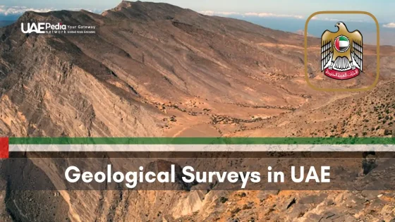
Advancements in Geological Research and Exploration
What if X-ray vision wasn’t just for superheroes? Modern tools now let scientists peer through layers of sand and stone like never before. Across the region, teams blend tech wizardry with old-school fieldwork to crack Earth’s ancient codes.
Modern Technologies
Ground-penetrating radar (GPR) acts like a geological metal detector—sending pulses to map buried rock layers. Seismic surveys use sound waves to create 3D underground portraits. “We’re finding fossil aquifers and mineral deposits we never knew existed,” shares Dr. Aisha Al-Mansoori, lead researcher at Sharjah’s Desert Science Center.
| Technology | Depth Range | Best For |
|---|---|---|
| GPR | 0-15 meters | Shallow sediment layers |
| Seismic Surveys | 500+ meters | Oil/gas reservoirs |
Fossil Discoveries
Last year, magnetic imaging revealed 8-million-year-old whale vertebrae near the western coast—proof this desert once rippled with seawater. Nearby, GPR uncovered a prehistoric mangrove forest preserved under salt flats. These finds help us piece together climate patterns spanning thousands of years.
Such breakthroughs guide smarter water management and habitat protection. As tech unlocks more secrets, the United Arab Emirates solidifies its role as a global hub for earth science innovation. Who needs superhero capes when you’ve got ground-penetrating radar?
Geotourism: Embracing Sustainable Exploration
Ready to discover landscapes that thrive because visitors care? Across the Emirates, a new wave of travelers is rewriting the rules—exploring natural wonders while actively preserving them. Geotourism isn’t just about snapping photos; it’s about leaving ecosystems healthier than you found them.
Operators now offer solar-powered desert camps and reusable water bottle systems. In Wadi Wurayah National Park, guided hikes fund wildlife conservation. “Every dirham spent here protects habitats,” says eco-tour guide Khalid Al-Mazroui. “Visitors become guardians simply by choosing responsible experiences.”
Eco-Friendly Practices
Stick to marked trails in sensitive areas like Al Ain’s fossil valleys. Opt for small-group kayak tours through mangroves—they minimize wake damage to root systems. Even packing out trash (yes, including orange peels) helps maintain delicate desert ecology.
Key spots balancing access with preservation:
- Jebel Hafit Desert Park’s fossil-protection zones
- Abu Dhabi’s carbon-neutral dune buggy tours
- Ras Al Khaimah’s community-run mountain trails
Local communities benefit too. Bedouin families host cultural nights using traditional materials, while fishing villages offer plastic-free boat trips. Your visit supports these guardians of the land—proving exploration and care can walk hand in hand.
Balancing Conservation and Development in the UAE
How do you build a metropolis without burying nature’s blueprints? The United Arab Emirates faces this puzzle daily, juggling skyscraper ambitions with ancient ecosystems. Abu Dhabi’s mangrove-protection laws and Dubai’s wildlife corridors prove progress needn’t bulldoze heritage. But the stakes are high—coastal flora and desert fauna hang in the balance.
Urban sprawl threatens fragile habitats. Roads slice through migratory paths, while groundwater extraction stresses salt-tolerant plants. Yet solutions emerge. At Jebel Hafeet, solar-powered lighting guides hikers without disturbing nocturnal species. “We’re rewilding with native species,” shares ranger Amal Khalid. “Even construction crews now avoid critical nesting seasons.”
Success stories spark hope. The Sheikh Zayed Protected Areas Network safeguards 19% of the country’s land and sea. Dubai’s Al Marmoom Reserve reintroduced Arabian oryx herds, while Sharjah’s wetlands host 50,000 migratory birds yearly. Private firms chip in too—developers offset carbon by planting ghaf trees, a keystone species.
| Challenge | Solution | Impact |
|---|---|---|
| Coastal erosion | Artificial coral reefs | +32% marine biodiversity |
| Sand dune destabilization | Native grass planting | 70% less desertification |
| Urban heat islands | Green roof mandates | 3°C temperature drop |
Your visit matters. Choose eco-certified tours in Ras Al Khaimah’s mountains. Skip plastic bottles—refill stations now dot trailheads. Snap photos of wildflowers, but let them seed. Every mindful choice helps this land honor its history while scripting a greener future.
Innovative Approaches in Geosciences and Education
Picture classrooms without walls—where GPS units replace textbooks and rock hammers become pens. Across the United Arab Emirates, universities are rewriting earth science education through boots-on-the-ground learning. Students don’t just memorize rock cycles—they map real wadis and analyze coastal erosion patterns firsthand.
Field Studies and University Programs
At UAE University’s geology program, undergrads camp near Jebel Hafeet to study ophiolite formations. They use drones to create 3D models of ancient seabeds now lifted into mountain ranges. “We’re training detectives of deep time,” says Professor Nadia Al-Hameli. “Every scratch on these rocks tells a tectonic story.”
NYU Abu Dhabi takes students to Jebel Faya’s archaeological sites. Here, tech meets tradition—laser scanners document Ice Age tools while local elders share Bedouin navigation techniques. These hybrid approaches help decode how early humans adapted to shifting landscapes.
| Program | Location | Tech Used |
|---|---|---|
| Desert Ecology Lab | Al Ain | Soil DNA analysis |
| Coastal Geomorphology | Fujairah | Wave simulation software |
Community outreach threads through every project. Zayed University’s ecology teams partner with mountain villages to monitor endangered flora. Their findings shape sustainable tourism plans that protect habitats while creating jobs.
Want to join? Public field studies welcome novices. You might help catalog fossilized coral near Khor Fakkan or test smart irrigation systems in desert farms. These hands-on adventures prove science isn’t just for labs—it’s alive in every canyon and coastline.
Reflecting on the UAE’s Enduring Geological Legacy
Time moves differently here. Every cracked limestone cliff and fossilized coral reef whispers tales from epochs when oceans retreated and mountains clawed skyward. This land doesn’t just host history—it is history, written in wadi carvings and dune migrations.
From the Hajar Mountains’ ancient seabed rocks to Jebel Faya’s Ice Age tools, these terrains reveal how earth-shaping forces birthed vibrant ecosystems. Coastal mangroves filter saltwater while desert acacias thrive in parched soils—a dance between flora and terrain perfected over millions of years.
Modern guardians now protect this legacy. Rangers monitor endangered fauna in Wadi Wurayah, while universities decode serpentine soils that challenge vegetation survival. Sustainable trails let you walk lightly through living classrooms where every sandstone layer holds discoveries.
Ready to add your chapter? Pack your curiosity and tread where Bedouin navigators once mapped stars onto stone. Share photos of fog-draped dunes or sabkha salt patterns—each click preserves stories for future generations. The Emirates’ greatest wonder isn’t just its past, but how we shape its next million years.
These rugged peaks formed over 70 million years ago from oceanic crust (ophiolites) thrust upward—think of Earth’s crust doing a slow-motion cannonball into the sky! Their serpentine rocks and deep wadis host rare plants like the Arabian caralluma, while villages cling to slopes where falcons still nest.
Absolutely! Dig into Jebel Faya’s limestone near Sharjah, and you’ll uncover ancient coral reefs and sea urchins—proof this area was submerged under the Tethys Ocean. Even camel-grazed deserts near Al Ain hide fossilized shark teeth from when sand was seabed.
Sabkhas are salty, low-lying flats where groundwater evaporates, leaving crusty mineral deposits. Walk Abu Dhabi’s coastal sabkhas at sunset, and you’ll see them shimmer like cracked porcelain—a stark contrast to the frothy mangroves nearby. These zones are geological time capsules, preserving climate clues from 6,000 years ago.
A> When dry quartz grains in mega-dunes like Liwa’s slip down steep slopes, they create low-frequency rumbles—nature’s dubstep! Wind patterns also sculpt ever-changing shapes, from crescent barchans to star dunes taller than 50-story buildings. Pro tip: Visit at dawn for cooler temps and sharper shadows revealing ripples.
Flash floods carve hidden water channels, sustaining “green pockets” like Wadi Wurayah’s waterfalls. Here, Arabian tahr goats scale cliffs, and dragonflies dart over pools lined with fig trees. Endemic species adapt through tiny leaves (less water loss) or burrowing—like the UAE’s secretive sandfish skink.
Geotourism hubs like Fujairah’s Semail Gap offer guided hikes through 90-million-year-old mantle rocks. Stick to marked trails to avoid disturbing fragile harzburgite layers, and join citizen science projects documenting petroglyphs or tracking mountain gazelle populations with ranger apps.
A> Abu Dhabi’s Jubail Island development buffers critical mangrove nurseries, while Dubai’s Qudra Lakes use treated wastewater to recreate desert oases. Universities partner on “living lab” projects—monitoring Jebel Hafit’s erosion or using AI to predict dune shifts near highways. Even skyscrapers incorporate local stone!