Think the UAE is all skyscrapers and deserts? Hidden between emirate borders lies a rocky wonderland where ancient trails carve through rust-colored cliffs and secret wadis glisten under the Arabian sun. This isn’t just a hike—it’s a journey through geological time.
Whether you’re chasing sunrise views from jagged peaks or navigating dry riverbeds that bloom after rare rains, our guide unlocks routes for every explorer. We’ve walked these paths ourselves, comparing notes with RoutesHikesOman data and local guides to bring you the clearest trail maps and safest strategies.
You’ll discover:
- Three-tiered routes sorted by difficulty—from family-friendly walks to expert-only ascents
- Where to find natural pools and shaded rest stops (hydration matters in this climate!)
- Pro tips for reading terrain markers and avoiding midday heat without missing golden-hour panoramas
Introduction to the Hajar Mountains Hiking Experience
The UAE’s best-kept secret isn’t found in malls—it’s etched into stone corridors older than civilization. Imagine trading elevator buttons for goat paths, where every turn reveals rust-hued cliffs and hidden waterfalls. This isn’t just a workout; it’s a conversation with the earth itself.
Local guides often say, “These rocks remember camel caravans and star maps older than GPS.” You’ll find trails that switch from heart-pumping ascents to serene plateaus where wildflowers nod in the breeze. Platforms like Ask Aladdin rave about routes where your footprints mingle with ancient traders’ paths—history you can touch.
We’ve mapped both crowd-favorites and whisper-quiet paths where:
- Sunlight paints canyon walls gold during golden hour walks
- Fossil beds sit beside modern-day picnic spots
- Village ruins hint at communities that thrived here long before skyscrapers
Whether you’re tracing dry riverbeds or navigating ridges with views stretching to Oman, every step connects you to the diverse mountain ranges that shape this region. Ready to trade concrete for geology’s greatest hits?
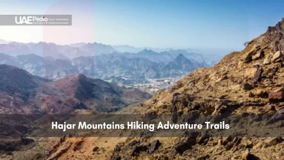
Diverse Hiking Trails and Scenic Landscapes
Trails here aren’t just dirt paths—they’re storytellers. Some routes hum with hikers snapping canyon selfies, while others whisper secrets through wind-carved arches. We’ve clocked miles using RoutesHikesOman data to map your options.
Where Crowds Gather and Cameras Click
The Jebel Shams Balcony Walk steals the show—a 4km track clinging to cliffs 1,200m above Oman’s “Grand Canyon.” Fit beginners handle it in 3 hours if they respect the drop-offs. Other favorites:
| Route | Distance | Difficulty | Reward |
|---|---|---|---|
| Wadi Ghul Loop | 9km | Moderate | 360° summit views |
| Snake Canyon | 5km | Challenging | Natural water slides |
| Misfah Trail | 6km | Easy | Terraced farms |
Paths Less Instagrammed
Want to trade hashtags for hidden villages? Try the 8km track near Al Sogara. Locals call it “the road of whispers” for its echoey passes. You’ll find:
– Fossil beds perfect for amateur paleontologists
– Abandoned stone homes with intact clay ovens
– Natural amphitheaters where goats outnumber people
These routes demand sharper navigation skills—think painted rocks, not signposts. But trust us: getting “temporarily misplaced” here often leads to the best stories.
Planning Your hajar mountains hiking adventure
Every great explorer knows: the right prep work transforms rocky paths into unforgettable journeys. Local guides often remind us, “Your water bottle matters more than your Instagram feed here.” Let’s break down how to match trails to your stamina and pack like a pro.
Selecting the Right Trail for Your Skill Level
Start by honestly assessing your fitness. Can you handle 4 hours of uneven terrain? Check trail grades using apps like AllTrails or local route maps. Our favorite method: the “Stairmaster Test.” If 30 minutes on max incline leaves you breathless, stick to routes under 5km.
| Trail Level | Distance Range | Key Features | Fitness Check |
|---|---|---|---|
| Beginner | 2-5km | Marked paths, minimal elevation | 1-hour brisk walk |
| Intermediate | 6-10km | Rocky sections, 300m+ climbs | 5k run completion |
| Advanced | 11km+ | Exposed ridges, scrambling | Multi-day trek experience |
Preparation, Permits, and Packing Essentials
Permits aren’t just red tape—they’re lifelines. Many routes require registration through platforms like Darbi or local tourism offices. Pack smart:
- 3L water per person (yes, even in winter)
- Electrolyte tablets to beat desert dehydration
- Printed map backup – phone signals vanish in canyons
Time your start before sunrise. Guide Ahmed Al-Rashid notes, “The 6 AM crew finishes smiling; the 9 AM group needs rescues.” Track progress with GPS watches, but always inform someone of your planned route and return time.
Must-Visit Highlights: Jebel Shams and the Balcony Walk
Imagine standing where the earth cracks open like a storybook—a 3,000-foot-deep canyon where eagles circle below your boots. Jebel Shams (“Mountain of the Sun”) earns its royal nickname as the Hajar range’s crowning glory. RoutesHikesOman data confirms what locals whisper: this track isn’t just a hike—it’s a pilgrimage for peak chasers.
Exploring the Grand Canyon Views
The Balcony Walk turns geology into theater. Picture this: a 4km ledge tracing Oman’s answer to the Grand Canyon, with rust-colored cliffs plunging into shadows. Fit hikers finish in 3 hours, but smart ones pause at hidden viewpoints. “Most Instagram that first bend,” says guide Fatima Al-Harthy, “but the real magic happens halfway—where the canyon narrows to a knife’s edge.”
Route Options and Duration Tips
Choose your adventure with these verified RoutesHikesOman tracks:
| Route | Distance | Duration | Best For |
|---|---|---|---|
| Summit Loop | 13.3 km | 6-8 hours | Sunrise seekers |
| Balcony Shortcut | 7.49 km | 3-4 hours | Golden hour photos |
Pro tips for conquering the track:
- Start before 7 AM—summer temps hit 104°F by noon
- Wear grippy shoes; loose gravel loves to slide
- Pack headlamps if chasing sunset from the summit
Leave time to sit where Bedouin herders once rested. Those canyon colors shift from burnt orange to molten gold as day fades—nature’s own curtain call.
Jabal Akhdar and Saiq Plateau Adventures
Forget desert mirages—Jabal Akhdar’s green terraces bloom where arid cliffs meet cloud forests. This western Hajar wonderland serves rose-scented breezes and canyon views so dramatic they’ll make your phone’s panorama mode sweat.

Scenic Overlooks and Local Accommodations
The adventure begins on a road that twists like a cinnamon roll. As you climb 2,000 meters, each hairpin turn reveals new perspectives—terraced pomegranate farms clinging to slopes, villages carved into rock faces. Vehicle track ends? That’s when luxury begins.
| Accommodation | Features | Local Touch |
|---|---|---|
| Alila Jabal Akhdar | Infinity pool overlooking canyons | Date palm-inspired architecture |
| Anantara Villas | Private plunge pools | Omani coffee rituals at sunrise |
| Saiq Plateau Camp | Stargazing beds | Bedouin-style wool tents |
Cultural Insights and Farming Heritage
Follow the stone track winding through Al Ayn’s abandoned settlements. Local guide Ahmed Musallam notes, “Our ancestors built water channels called falaj—some still irrigate apricot trees after 500 years.”
Don’t miss the rosewater distilleries in April. Women from mountain villages still harvest dawn-picked petals using methods unchanged since frankincense trade routes began.
Pro tips for explorers:
- 4WD mandatory—the main route has 60-degree inclines
- Carry extra water; natural springs are rare above 2,500m
- Time visits with full moons for illuminated canyon walks
This western Hajar track isn’t just a hike—it’s a living museum where every almond grove whispers stories of resilience.
Off-Road Experiences and Wadi Explorations
Desert roads turn into rollercoasters here—where your 4WD becomes a time machine rattling through rust-colored canyons. RoutesHikesOman data shows over 60% of visitors to Wadi Bani Awf underestimate two things: the thrill of navigating dry riverbeds and the patience required when sand claims your tires.
Wadi Bani Awf Crossing and Snake Canyon Thrills
The 35km track from Al Hamra village isn’t for the faint-hearted. Local guides joke, “If your suspension doesn’t scream, you’re doing it wrong.” You’ll crawl over boulders the size of SUVs, ford shallow streams, and squeeze through passes where canyon walls nearly touch your mirrors.
Snake Canyon earns its name with serpentine twists and sudden drops. RoutesHikesOman recommends these essentials:
- Vehicle: True 4WD with high clearance (Jeep Wranglers dominate here)
- Time: 4-6 hours for the full crossing—start by 7 AM to avoid midday heat
- Navigation: Follow painted rocks marked “SA” for safe passage
Driving and Trail Navigation Tips
Gravel roads here play tricks. What looks solid often hides soft sand traps. Veteran driver Salim Al-Rashid advises: “Air down tires to 18 PSI before the first wadi—it’s the difference between floating and digging.”
| Challenge | Solution | Tool Kit Must-Haves |
|---|---|---|
| Steep ascents | Low gear, steady throttle | Recovery boards |
| Flash floods | Check UAE Met app hourly | Weather radio |
| Route confusion | GPS coordinates from local guides | Paper maps + compass |
Pack extra water and satellite phones—cell signals vanish faster than mirages. Most rescues happen when drivers ignore one rule: never tackle these tracks solo after rain. That “shallow stream” could become a raging torrent in 20 minutes.
Cultural Encounters in Nizwa and Al Hamra
Step off the trail and into living history where clay forts guard spice-scented alleyways. Nizwa’s 17th-century fortress isn’t just a photo stop—it’s a time capsule where you’ll find sword makers practicing ancestral crafts beside date sellers haggling in rapid Arabic.
Historic Forts and Traditional Souks
The iconic Nizwa Fort dominates the skyline with its 40-meter watchtower. Local guide Rashid Al-Maamari shares: “Friday mornings transform the square—farmers bring goats tied to pickup trucks, silver traders unfold embroidered khanjars, and the air hums with Omani dialects.”
| Nizwa Must-Sees | Al Hamra Gems | Best Time |
|---|---|---|
| Fort Museum | Al Hoota Cave | 7-10 AM |
| Goat Market | Bait Al Safah | Fridays |
| Silver Souk | Misfat Al Abriyeen | Cooler months |
Exploring Al Hoota Cave and Local Villages
Swap sunlight for subterranean wonder in Al Hoota Cave—a 4.5km limestone labyrinth. Stalactites drip like frozen waterfalls above an underground lake teeming with blind fish. Guides here joke: “Our cave map changes slower than geology class.”
Nearby villages like Misfat Al Abriyeen cling to cliffs using ancient falaj irrigation. Stone paths wind past coffee houses where elders play dominoes. Pro tips:
- Hire a village guide—they’ll show hidden lookouts
- Wear grippy shoes for slick cave pathways
- Check road conditions—mountain routes need 4WD
These cultural treasures prove history isn’t confined to museums. When you sip cardamom coffee in a 300-year-old majlis, you’re not just visiting—you’re part of the story.
Essential Safety Tips and Gear Checklists
Your gear isn’t just stuff—it’s your lifeline when cliffs get steep and shadows grow long. We’ve hiked these routes with guides who’ve pulled tourists from flash floods and patched blisters at 2,500 meters. Here’s how to pack like someone who actually knows where the cell signals drop.
Must-Have Equipment and Clothing
Local outfitters swear by the “3-Layer Rule”: moisture-wicking base, insulated mid-layer, windproof shell. “Cotton kills here,” warns Muscat Adventure Group’s lead guide Khalid Al-Farsi. “One unexpected rain shower turns tee-shirts into ice packs.”
- Footwear: Ankle-support boots with Vibram soles (sandals stay in the car)
- Hydration: 3L bladder + electrolyte tablets—sip every 20 minutes
- Navigation: GPS watch preloaded with RoutesHikesOman tracks
- Emergency: Compact first aid kit with blister pads and snakebite protocol
Route-Specific Safety Precautions
Night hikes demand extra caution. Moonlit paths might look magical, but hidden drop-offs don’t care about your Instagram aesthetic. Always:
| Route Type | Essential Gear | Pro Tip |
|---|---|---|
| Canyon Trails | Waterproof bag | Check UAE Met app hourly |
| Summit Climbs | Headlamp + spare batteries | Turn back if winds exceed 25mph |
| Wadi Crossings | Quick-dry pants | Never camp in dry riverbeds |
Guides from Desert Discovery Tours emphasize: “If your gut says ‘nope,’ listen. The track isn’t going anywhere—come back smarter.” Print emergency contacts on waterproof paper, and remember: the best adventures happen when preparation meets spontaneity.
Best Time to Hike: Weather and Seasonal Considerations
Timing your trek here isn’t about convenience—it’s survival poetry written in sun and shade. We’ve learned through sweat-soaked bandanas and surprise rain showers: this desert climate rewards planners and punishes procrastinators.
Prime hiking months run November to March. Daytime temps hover around 75°F—perfect for canyon walks without becoming human jerky. Local guides whisper a rule: “If your shadow looks crispy at noon, you’re 3 hours late.”
| Season | Avg Temp | Best For | Considerations |
|---|---|---|---|
| Winter (Dec-Feb) | 68-82°F | Full-day expeditions | Pack layers for chilly dawns |
| Spring (Mar-Apr) | 85-95°F | Morning wadi hikes | Watch for flash floods |
| Summer (May-Sep) | 104-115°F | No sane hiking | Stick to sunrise viewpoints |
Check forecasts like your life depends on it—because it might. The UAE’s National Center of Meteorology app updates hourly. Pro tip: Track cloud formations west of Al Ain; they signal incoming weather shifts faster than any algorithm.
Start trails by 6 AM during warmer months. Those golden hours aren’t just photogenic—they’re safety buffers. Carry a headlamp for unexpected delays, and always inform someone of your return time.
Mountain microclimates flip faster than a camel’s mood. One minute you’re basking in sunshine, the next you’re scrambling for cover from horizontal rain. Our emergency kit always includes a lightweight poncho and electrolyte sachets.
Smart hikers don’t fight the desert—they dance with its rhythms. Time your day around shade pockets and water breaks, and you’ll unlock trails that feel custom-made for your boots.
Mapping Your Route: Navigation Tools and Local Guides
Lost in these ancient corridors? Not today. Modern explorers blend satellite precision with Bedouin wisdom to navigate this stone labyrinth. Whether you’re tracing a wadi’s curve or chasing ridge views, smart navigation turns potential misadventures into triumphs.

Using Digital Maps and Trail Apps
Your phone isn’t just for canyon selfies—it’s a survival tool here. Apps like AllTrails and Komoot dominate local trekker chats, offering crowd-sourced updates on washed-out paths and water sources. RoutesHikesOman’s verified tracks shine here, with color-coded difficulty ratings and “photo proof” waypoints showing exact trail conditions.
- Gaia GPS: Stores offline maps for signal-free zones
- Windy.com: Predicts sudden weather shifts
- Strava Heatmaps: Reveals popular local routes
Tapping into Local Expertise
No algorithm beats a guide who’s walked these rocks since childhood. Ahmed Al-Habsi, a third-generation mountain expert, advises: “Digital maps show where to go—we teach how to listen when the trail speaks.” Hire through vetted platforms like ExploreHajar or Desert Adventures UAE for guides who:
- Decipher fading paint markers on boulders
- Share shortcuts around seasonal waterfalls
- Point out edible plants during emergencies
Always pack a printed map from tourism offices—your tech might falter, but paper never crashes. Pair GPS coordinates with a guide’s sunrise-start advice, and you’ll master routes that balance tech smarts with timeless wisdom.
Hiking Tips for Beginners and Seasoned Adventurers
Your boots hit the trail—now what? Whether you’re lacing up for your first desert trek or chasing your twentieth summit, smart preparation turns rocky paths into triumphs. Let’s unpack how to train your legs and adapt your stride for whatever the terrain throws your way.
Training and Fitness Preparation
Think of your body as a desert rover—it needs tuning before tackling jagged routes. Fitness coach Layla Al-Mansoori suggests: “Three weeks of stair climbs with a weighted pack beats any gym membership.” Start with these essentials:
- Daily squats and lunges to build quad endurance
- Balance drills on uneven surfaces (try backyard rocks)
- 30-minute brisk walks with sudden stops to mimic trail pauses
| Skill Level | Weekly Routine | Progression Tip |
|---|---|---|
| Newcomers | 2-mile flat walks + core exercises | Add 10% distance weekly |
| Intermediate | Hill repeats + ankle weights | Simulate elevation gain |
| Experts | Multi-hour scrambles + load carries | Test gear under stress |
Adapting to Varied Terrains
Gravel, sand, and slickrock each demand different tactics. On steep ascents, shorten your stride and lean slightly forward. When descending, bend knees and let gravity assist—think controlled falling.
Seasoned trekkers swear by these adjustments:
- Beginners: Focus on rhythm over speed—count steps to maintain pace
- Veterans: Practice “micro-rests”—10-second pauses to reset form
- All levels: Side-step across loose gravel to prevent slips
Local guide Omar Al-Farsi reminds us: “The smartest hikers listen to their calves whispering before they scream.” Pack moleskin for hotspots, and remember—every great adventure began with someone deciding to try.
Sampling Local Cuisine and Mountain Hospitality
Your boots crunch on ancient trails, but the real journey begins when villagers wave you toward steaming platters. Here, every meal feels like a celebration of earth and community. “Food isn’t just fuel here,” says Al Hamra guide Salima Al-Rawahi. “It’s how we say ‘welcome’ without words.”
Follow woodsmoke trails to family-run cafes in Misfat Al Abriyeen. Clay ovens produce paper-thin khubz bread paired with date syrup—perfect trail fuel. Don’t miss Friday feasts in Nizwa:
- Harees: Slow-cooked wheat and meat, served at sunset gatherings
- Shuwa: Marinated lamb wrapped in banana leaves, buried for days in smoldering pits
- Omani halwa: Rosewater-infused gelatinous sweet, best with bitter Arabic coffee
Village hospitality shines brightest when least expected. A farmer might press fresh pomegranate juice into your hand near Wadi Bani Awf. In Saiq Plateau, families often invite hikers to share majboos—spiced rice with dried lemon—on shaded patios.
Pro tips for culinary explorers:
- Ask guides about “hidden” eateries—like Al Hamra’s rooftop dates-and-cheese spot
- Time hikes to reach Jebel Akhdar’s rose harvest cafes during April blossom season
- Carry small bills; many mountain vendors don’t accept cards
These flavors don’t just feed your body—they weave you into the region’s living tapestry. As the locals say while passing saffron tea: “The best views taste even sweeter.”
Embracing Nature: Environmental Awareness and Conservation
Every footprint tells a story here—but the best ones leave no trace. As more explorers discover these wild spaces, protecting their fragile beauty becomes part of the journey itself. Local rangers often remind us: “Take only photos, but leave the lessons nature teaches.”
Walking Lightly on Ancient Ground
The Leave No Trace principles aren’t just rules—they’re love letters to the land. Adapted from global outdoor ethics and Oman’s eco-tourism initiatives, these guidelines help preserve delicate ecosystems:
| Principle | Action | Why It Matters |
|---|---|---|
| Plan Ahead | Pack reusable containers | Reduces plastic waste in dry climates |
| Travel Smart | Stay on marked tracks | Protects rare desert plants |
| Dispose Right | Carry out all trash | Prevents wildlife hazards |
| Respect Wildlife | Observe from distance | Maintains natural behaviors |
Water sources here are lifelines. Refill bottles at designated stations rather than natural springs—some sustain entire villages. Guides recommend silicone collapsible bottles that pack flat when empty.
In caves and narrow routes, avoid touching mineral deposits. Omani geologist Dr. Amal Al-Habsi explains: “Oil from skin speeds erosion in limestone formations. What took millennia to create can crumble in decades.”
Even small choices matter. Use biodegradable soap 200+ feet from streams. Bury human waste 6-8 inches deep. Snap that canyon selfie without moving rocks for a “better view.” Future hikers should experience the same wild wonder you did.
Real Traveler Experiences and Inspiring Stories
Behind every dusty bootprint lies a memory waiting to inspire. We’ve gathered firsthand accounts from those who’ve navigated these ancient paths—stories that pulse with triumph, humility, and the raw beauty of discovery.
Testimonials from Fellow Hikers
“Our guide pointed out constellations while we camped under a sky so clear, it felt like we could touch the Milky Way. That midnight walk through Wadi Tiwi’s palm groves? Pure magic.”
RoutesHikesOman reviewers rave about unexpected moments. One family’s “wrong turn” near Jebel Akhdar led to a hidden apricot orchard where villagers shared fresh juice. Others recount heart-pounding stories:
- A solo trekker’s sunrise summit after battling vertigo on exposed ridges
- Retirees completing their first multi-day route with local support teams
- Teens documenting fossil finds using a guide’s weathered field notes
“Day three tested everything—blistered feet, dwindling water, and a sandstorm. But cresting that final ridge? Worth every shaky step.”
These snapshots prove every route offers its own lessons. Whether you’re drawn to silent canyon echoes or the camaraderie of group hikes, real stories light the way. As one traveler put it: “The rocks remember your courage long after you’ve gone home.”
Integrating Adventure with Local Culture in the UAE and Oman
Where rugged trails meet steaming coffee pots—this is where true exploration begins. The eastern Hajar’s cliffside paths and western Hajar’s terraced farms aren’t just routes; they’re gateways to living traditions. Imagine swapping trail mix for dates offered by villagers, or pausing your ascent to watch artisans weave palm fronds into baskets older than your hiking boots.
Local guide Fatima Al-Maamari puts it best: “Our roads connect more than places—they link centuries.” Follow these cultural threads:
- Barter for silver khanjars (daggers) in Nizwa’s Friday market after conquering Jebel Shams
- Join Al Hamra families pressing pomegranates into syrup—a sweet reward post-hike
- Sleep under stars in Misfat’s restored mud houses, where breezes carry tales of frankincense traders
Respect opens doors here. Cover shoulders when entering villages. Ask permission before photographing craftspeople. Time visits with cultural touchpoints:
| Region | Experience | Best Season |
|---|---|---|
| Eastern Hajar | Rosewater distillation workshops | April |
| Western Hajar | Date harvest festivals | July-August |
These moments transform routes into memories. As the setting sun paints Jebel Akhdar’s cliffs gold, you’ll realize: the real summit isn’t a peak—it’s sharing stories with those who call these stones home.
Parting Insights for Your Hajar Mountains Journey
Every trail here leaves footprints on your soul—sun-baked ridges that test your grit, star-drenched nights that humble your sense of scale. As we wrap this road map to stone-carved wonders, let’s cement what matters most.
Pack these essentials for your walk through time:
• Refresh weather apps hourly—desert skies switch moods faster than a camel chews
• Double-check that guide-approved GPS track before sunrise starts
• Leave space in your pack for village-made halwa and unexpected invitations
This landscape rewards those who blend preparation with curiosity. Did you know night hikes reveal constellations unseen in light-polluted cities? Or that one hidden wadi near Al Hamra blooms scarlet after rare rains?
Respect remains your best travel companion. A nod to elders, covered shoulders in settlements, and silent awe at fossil beds—these gestures open doors no permit can. As the adventure winds down, you’ll realize the journey never truly ends. Those rust-hued cliffs? They’ll whisper for your return.
Ready to write your one unforgettable chapter? Lace up, charge your devices, and step onto paths where every stone tells a story. The mountains await.
Aim for October-April when temperatures dip below 30°C (86°F). Summer treks require pre-dawn starts – we’ve seen seasoned hikers retreat by 9 AM when mercury hits 40°C (104°F) in shaded areas!
A>Add grippy soles for limestone scrambles and pack arm sleeves – razor-sharp rocks bite through thin fabrics. Night hikers: 95% of trails lack lighting, so headlamps with red-light mode preserve night vision without blinding your group.
A>Wadi Tiwi’s lower pools require just 45 minutes of easy walking to reach turquoise swim spots. For cliffside drama without vertigo, Jebel Akhdar’s Diana’s Viewpoint trail serves Instagram-worthy canyon vistas on a paved 1.5km loop.
A>Trails entirely within UAE (like Wadi Ghalilah) need no paperwork. Crossing into Oman? Carry passports – police checkpoints near Jebel Qihwi require border permits. Local guides handle this if you book through licensed operators.
A>Jebel Shams’ Balcony Walk edges out rivals – this 4km cliff-hugger reveals the Middle East’s answer to the Grand Canyon. Go post-rainfall (Nov-Jan) when waterfalls stripe the 1,000m-deep abyss. Pro tip: sunset turns the limestone walls molten gold.
A>Download maps.me or Maps3D for offline use – Google Maps fails past trailheads. Stone cairns mark major routes, but painted arrows fade. When in doubt, follow dried goat droppings (seriously – they’re the original trailblazers).
A>Al Hamra’s 400-year-old mudbrick homes host date coffee ceremonies. Time hikes to reach Bimmah Sinkhole by Friday mornings when Omani fishermen grill freshly caught hamour over salt-encrusted stones.
A>Stock up on halwa – this rosewater-infused gelatinous sweet provides quick glucose hits. Village stalls sell “shakshouka” omelets wrapped in khubz bread – perfect handheld protein. Camel milk stops dehydration better than sports drinks (science says so!).
A>Snake Canyon’s 12km gorge demands 8+ hours of waterfall rappels and icy waist-deep wades. Guides mandatory – we’ve watched flash floods transform trickles into Class IV rapids in 20 minutes. Not for the faint-hearted!
A>Pack out toilet paper – decomposition takes years in arid climates. Stick to established fire rings if camping. That “harmless” wild almond branch you broke for a walking stick? It’s someone’s ancestral shade source – leave flora untouched.